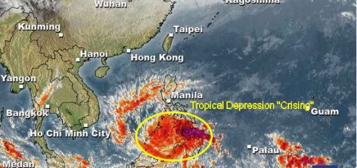
Tropical Depression “1331 / Zoraida” got a bit weaker

The new Tropical Depression “1331 / Zoraida” got a bit weaker today. The pressure raised from 1000 to 1002 hPa. Forecast for tomorrow is 996 hPa.
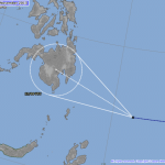
TD “1331 / Zoraida” is expected to accelerate northwestward during the next 24 hours and slightly turning west-northwestward through 48 hours. On the forecast track, the core of TD “1331 / Zoraida” will make landfall along the border of Surigao Del Sur and Davao Oriental, then passing across Agusan Del Sur, Bukidnon and Misamis Oriental on Tuesday afternoon through evening.

Wind will not be strong – about 45 to 65 km/h, but beware of the rain.
Rainfall may trigger floods and landslides!
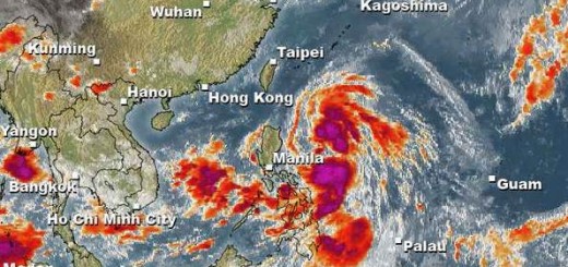
We keep an eye on this coming storm:
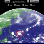
Current weather is here 
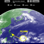
Animated weather movies are here
Related posts
 November 11, 2013 Tropical Depression “1331 / Zoraida” – stays south Tropical Depression “1331 / Zoraida” seems to stay more south. Latest JMA forecast tracks show that the TD will make landfall tomorrow […]
- January 14, 2015 The Pope’s Depression The Pope's Depression is approaching Samar. The Tropical Depression 01W will intensify and arrive in Samar when the Pope will visit Leyte. […]
- April 20, 2014 New Tropical Depression forming A new Tropical Depression (LPA 98W) is forming east of Palau. The TD is slowly moving westwards, towards the Philippines.
Weather is […]
- April 6, 2014 PEIPAH/Domeng – nobody knows PEIPAH/Domeng - no useful forecast available. The depression/storm is playing tricks with forecasters while it has entered PAR […]
- April 4, 2014 Tropical Depression changes direction The Tropical Depression (TD 05W ) still east of Palau moving west to northwest towards the Philippines.
The forward speed is about 15 […]


Recent Comments