El Niño 2018/19 developing? Will there be a drought in the Philippines?

Is El Niño 2018/19 developing?
The rather rainy days here in the south for now almost two weeks made me check our El Niño / La Niña page. Usually the lousy 8 winter weeks start in December. When I saw the animated maps from NOAA, I wondered about the current ENSO status. The ENSO status is another name for the El Niño / La Niña effects. ENSO means “El Niño/Southern Oscillation”. All the maps are property of NOAA.
Here they are:
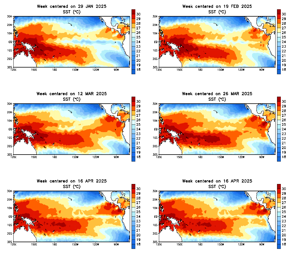
This is the absolute surface temperature map
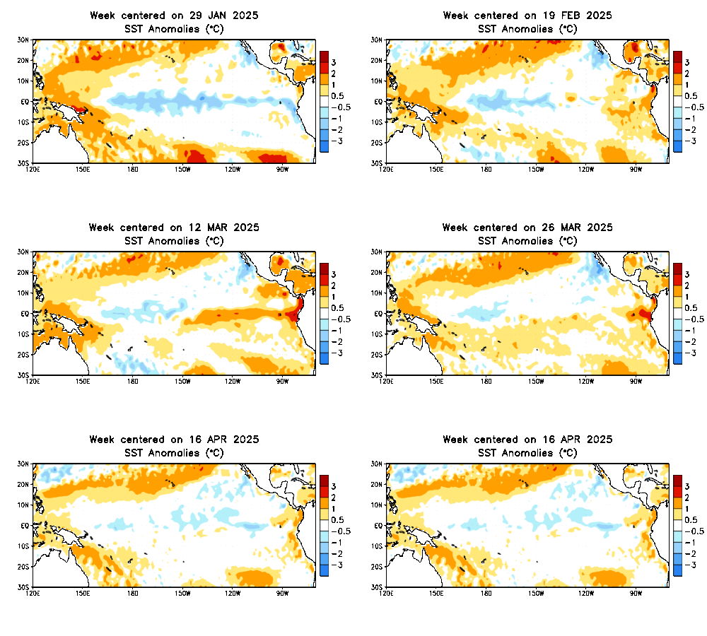
This is the anomalies map
This second map clearly shows that the equatorial waters are too warm.
Is El Niño 2018/19 developing?
The NOAA Climate Prediction Center writes:
El Niño is expected to form and continue through the Northern Hemisphere winter 2018-19 (~80% chance) and into spring (55-60% chance).
ENSO-neutral continued during October, despite widespread above-average sea surface temperatures (SSTs) across the equatorial Pacific Ocean [Fig. 1]. All four Niño regions showed increased SST anomalies in October, with the latest weekly values near +1.0°C in the Niño-4, Niño-3.4 and Niño3 regions, and +0.2°C in the Niño-1+2 region [Fig. 2]. Positive subsurface temperature anomalies (averaged across 180°-100°W) also continued [Fig. 3], due to the persistence of above-average temperatures at depth across the eastern half of the equatorial Pacific Ocean [Fig. 4].
However, atmospheric convection remained slightly suppressed near the Date Line and over Indonesia [Fig. 5]. Low-level westerly wind anomalies were observed over the eastern Pacific during October, while weak upper-level westerly wind anomalies were present over the far western Pacific. The traditional and equatorial Southern Oscillation indices were near zero. Despite the above-average ocean temperatures across the equatorial Pacific Ocean, the overall coupled ocean-atmosphere system continued to reflect ENSO-neutral.The majority of models in the IRI/CPC plume predict a Niño3.4 index of +0.5°C or greater to continue through the rest of the fall and winter and into spring [Fig. 6]. The official forecast favors the formation of a weak El Niño, with the expectation that the atmospheric circulation will eventually couple to the anomalous equatorial Pacific warmth. In summary, El Niño is expected to form and continue through the Northern Hemisphere winter 2018-19 (~80% chance) and into spring (55-60% chance; click CPC/IRI consensus forecast for the chance of each outcome for each 3-month period).
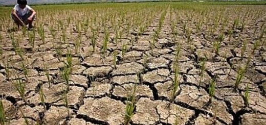
Translated in every day’s language this means that we have to expect a dry winter and probably also a drier spring. An El Niño 2018/19 is very probable!
I don’t think that it get as hard as in 2015 when the southern Visayas and Mindano were extra dry. In Camiguin not one drop of rain fell during almost 4 months.
For now I rather look eastward. There is a Tropical Depression developing. This TD 89C has a high probability to bring a typhoon to the Philippines.
[GARD]





Recent Comments