Tropical Storm IN-FA moving west
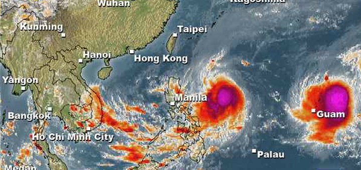
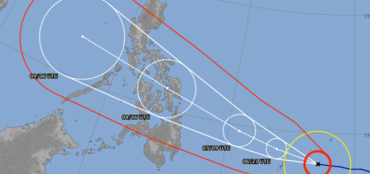
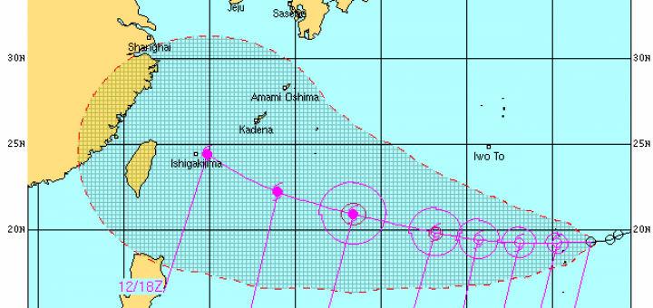
Tropical Storm IN-FA is moving west. This storm is still far away from the Philippines but has the potential to amplify to a Typhoon Cat. 3. Currently the storm is located over Micronesia south of...
Tropical Storm KOPPU/Lando advanced a bit slower than forecasts predicted. While still moving westward it gained a bit of strength. The circular motion is not yet stable. The winds around the centre are now...
Tropical Storm KOPPU/Lando continues on its westward track. It has slightly slowed down the forward speed from 25 to 20 km/h. It has maintained wind speed (strength). Forecast Tropical Storm KOPPU/Lando will continue to...
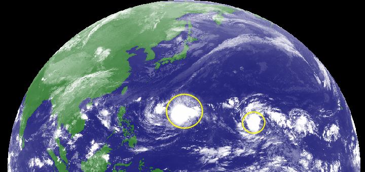
Two Tropical Depressions in a row are approaching the Philippines. The nearer one at 142° E, is moving westward at 15 km/h. The second one at 161° E, moves northwest at 10 km/h. Up...
Last weekend, Tropical Storm LINFA/Egay brought a lot of rain over northern Luzon. Now it is enhancing the southwest monsoon (Habagat) together with the 2 Typhoons CHAN-HOM (Cat.1) and NANGKA (Cat.4). Animated satellite...
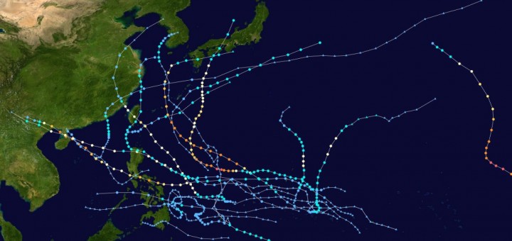
Typhoon season 2014 started in April with Tropical Storm PEIPAH / Domeng. Since then already 17 cyclones crossed over the waters of the northwestern Pacific. Only 2 Typhoons and 5 Tropical Depressions (TD) or Tropical Storms (TS) crossed the...
A very tasteless hoax circulates these days on social media sites: “Agaton or Yolanda Part 2 Super Typhoon to hit the Philippines”. There is nothing! The satellite image of the northern Pacific of this...
First of all sorry for the month off. I had been traveling between snow, ice and rocks and Röschti. Super Typhoon HAIYAN / Yolanda, currently a Cat. 4 Typhoon, is approaching the Philippines. The...
There are currently two typhoons on nearly the same track. First in line is Typhoon FITOW / Quedan now passing north-east of Taiwan heading towards mainland China. And second is newly upgraded Typhoon DANAS being...
Typhoon USAGI / Odette moved slightly eastwards. Friends from Hongkong informed us that the streets are empty, no ships are sailing and Cathay Pacific had suspended some flights. Here in Camiguin we lived with...
Typhoon UTOR / Labuyo has significantly intensified during its approach of the Philippines. Already by noon peak wind speeds of 230 km/h were measured. Rainfall is getting heavy with 300 mm in 24 hours. DANGER: Aside the...
During last night Tropical Depression 11W / Labuyo has strengthened and is now a Tropical Storm called UTOR / Labuyo. It continues to move towards Central/Northern Luzon. Storm data: Name (INTL. / local): UTOR...
Tropical Depression 11W / Labuyo has accelerated its forward speed to 26 km/h and maintained its internal strength during the past 12 hours. The storm is now inside the Philippine Area of Responsibility (PAR)....
A strong Tropical Disturbance (LPA) 96W which had been spotted yesterday over the Western Pacific, west of Guam has rapidly strengthened into Tropical Depression 11W / Labuyo. The storm develops quickly and has the...
Typhoon SOULIK/Huaning has maintained its weakening trend as well as its westerly motion during the past 6 hours. There is still an important danger for Yaeyama Islands and Taiwan. Typhoon SOULIK/Huaning is now classified as...
The Powerful Typhoon SOULIK / 07W has entered the northeastern border of the Philippine Area of Responsibility (PAR) and got the local name “Huaning. This typhoon is so strong that it could become a Super...
The strong Tropical Storm (TS) SOULIK/07W has again strengthened and is now a Typhoon Cat.1. This system is moving west at the northern limits of the zone that could become dangerous for the Philippines. The...
The strong Tropical Depression (TD) north of Guam has strengthened into a Tropical Storm SOULIK/07W. It is now passing very close to the northernmost part of Mariana Islands and still heading towards Taiwan/Okinawa region....
The Low pressure Area (LPA) o7W is already a Tropical Depression TD and is quickly increasing in strength. JMA and US Navy forecast typhoon strength within 2 days. The new TD should cross 20°...
I am not sure, but when I checked the latest satellite images, I had the feeling that the storm is developing an eye. None of the meteorological agencies has yet informed about this development....
Recent Comments