Great: Project NOAH helps now!
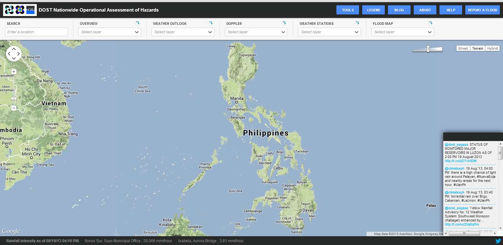
Project NOAH
NOAH stands for Nationwide Operational Assessment of Hazards. This tool developed by DOST is a great help for weather forecast and disaster prevention.
Our congratulations go to DOST and PAGASA. 

The maps supplied by Google allow many overlays. These overlays can be switched on and off by selecting them from the drop-down menus on the top.
On the right side is a small window with continuous updates and in the footer one finds as a scrolling text the latest PAGASA Tweets.
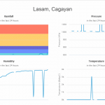
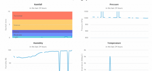
Among the overlays are rain statistics and rain forecasts:

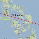
There are also 4 “Doppler” radar station investigating the water content of the atmosphere:

A great tool. But unfortunately only few Pinoy/Pinays can read a map. I asked around in our family and found that neither kids nor parents nor grand-parents can find our home-town on the map. On a world map they are completely lost and can’t find the Philippines until the name of their nation is readable.
This is NOW a challenge for the schools. Learn your kids reading maps. Do it NOW!
And do not forget! Bookmark: http://noah.dost.gov.ph/
Related posts
 July 31, 2016 Tropical Storm NIDA / Carina now at the northern end of Luzon Tropical Storm NIDA / Carina is now in the vicinity of Sta. Ana (Aparri) in the north of Luzon. The exact centre cannot be […]
- November 7, 2013 PAGASA is back The PAGASA website is back, but extremely slow.
Also the Project NOAH website is on-line again.
- May 4, 2011 Lufthansa Technik Philippines builds a new facility Since 2002 the Joint Venture company Lufthansa Technik 51% And MacroAsia Corporation 49%, invest USD 30,000,000 in a new building where […]
- May 8, 2008 Fast changing visa regulations for overstaying On March 11 the Bureau of Immigration closed its counter at Manila NAIA.
"The Bureau of Immigration (BI) has advised departing foreign […]
- March 24, 2019 Philippines Sky – it’s more fun up there in the air Philippines Sky becomes more busy. Within a few hours we learned about two new connections over our heads. One operator is an airline and […]


Recent Comments