Tropical Storm NOUL getting stronger
Tropical Storm NOUL is currently moving slowly westward. Japan Meteorological Agency predicts that Tropical Storm NOUL will become a typhoon category 1 tomorrow.
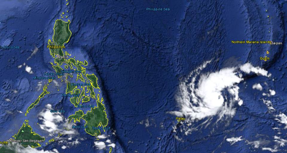
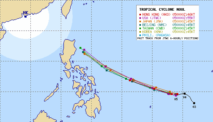
Tropical Storm NOUL is gaining strength. The central pressure went down from 1000 hPa to 985 hPa. WInd speed increased to 85 km/h near the center and gusts up to 110 km/h. The storm doesn’t move much. It hovers in the vicinity of Yap. The track is still not stable but forecasts show a clear trend towards northern Luzon.
 With increasing strength the track will become more stable.
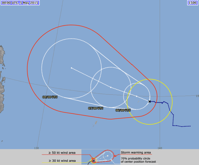
NOUL Storm Forecast
 Tropical Storm NOUL is expected to arrive in northern Luzon between Mai 10 and Mai 12.
NOUL Storm data:
| Name (INTL. / local): | NOUL / — |
| Class: | Tropical Storm |
| Time/Date of observation: | 05:00 AM on May 04, 2015 |
| Location of Center: | 9.6º North 139.2º East |
| Moving Direction and Speed: | West @ 06 km/h |
| Moving towards: | Philippine Islands |
| Distance from the Philippines: | 1,460 km E of Surigao |
| Estimated Date / Time of Landfall: | n/a |
| Max. Wind Speed near Center: | 85 km/h |
| Peak Wind Gusts: | 110 km/h |
| Minimum Central Pressure: | 985 hPa |
| Diameter: | 500 km |
| 24h Rainfall near Center: | 100 – 500 mm |
| Max. Wave Height: | 8 – 10 m |
| Here you find how to read and understand this data | |
Nearly real-time storm information
[GARD]
Related posts
 May 6, 2015 Cyclone NOUL almost Typhoon As predicted, Cyclone NOUL will be upgraded to a Typhoon Category 1 today. This might even happen a bit earlier. Central pressure went […]
- May 4, 2015 Tropical Storm NOUL The Tropical Depression seen end of last week got stronger and better organized. Tropical Storm NOUL is currently moving slowly […]
- November 22, 2011 Happy Birthday – 75 Years “LIFE” LIFE! One of the best publications the USA ever brought to our planet is celebrating its 75th birtday.
Fortunately my dentist had been […]
- March 20, 2012 Bad Press for CAAP In a press conference held at the CAAP headquarters in Pasay City yesterday morning, the Civil Aviation Authority of the Philippines […]
- July 31, 2013 Update: Legazpi reconnected ! Energy Secretary Jericho Petilla has ordered the reconnection of Albay Electric Cooperative (Aleco) to the national power grid by 5 p.m. […]


Recent Comments