Earthquakes News
Since 2011 we record all the earthquakes in the Philippines. Every year we encounter about 2000 earthquakes. Most of them are weak, but about 12% are felt and about 5 or 6 are very strong with damages.
You may ask why we do this. PHIVOLCS publishes daily Earthquakes Bulletins, but they do not publish any statistical data. And their maps are not very accurate (see below). During all these years we to fight against the bad data format of the PHIVOLCS publication. Their data had been entered in a MS-Word document. Their operators showed a lot of creativity by entering any funny characters, spaces, non blank spaces and tab settings. We intercepted all possible format changes, but it happened at least once a week, that the data was so badly formatted that our program caught a severe hiccup.
September 7, 2015 – A big improvement
At this date, PHIVOLCS changed their data format for the Earthquakes Bulletin and started to use fixed width tables. Each column now contains exactly the same data with the same format. What a pleasure!

We just had to adapt our almost 5 years old program that automatically extracts the data from the new source. This program runs automatically once per hour, checks if there are new earthquakes and if yes, inserts them in our database. This makes sure that you always get the latest updates when you visit our Earthquakes page.
Our Earthquakes maps
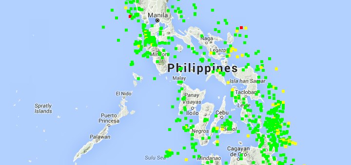
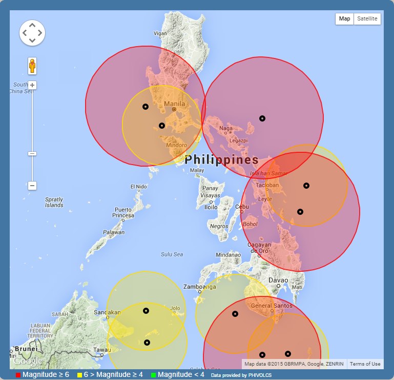
The first map shows all earthquakes of the current year. This allows you to see at a glance, where most of the earthquakes occur and where it is rather calm.
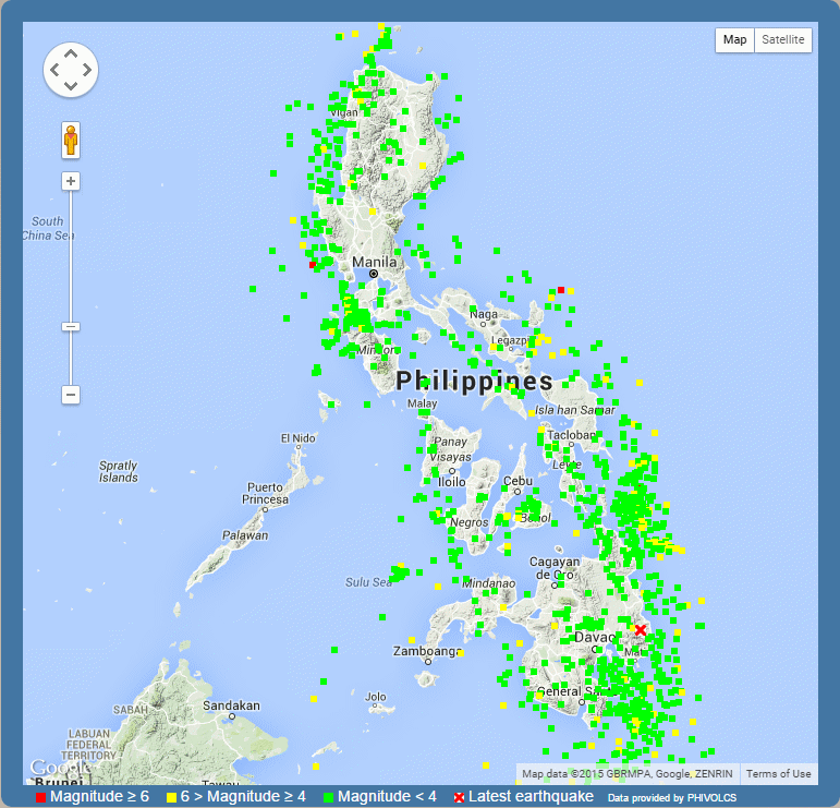
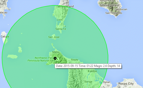
Clearly visible are this year’s hot spots east of Surigao and south-east of Davao. All our maps can be zoomed in and out. Below is such a zoomed in map of Panay. Panay is a very calm island.
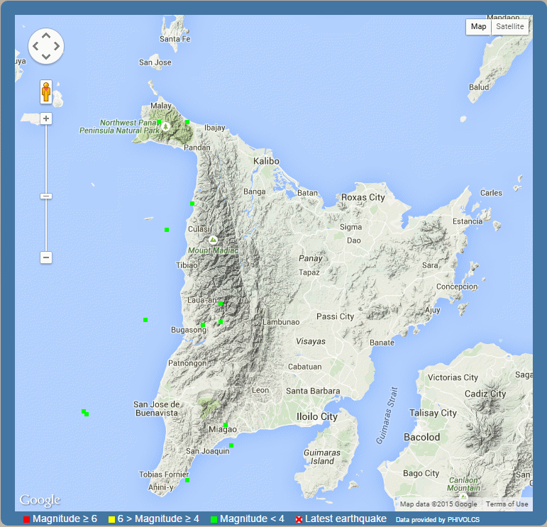
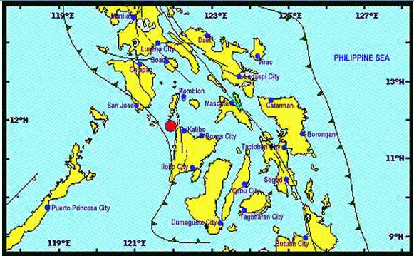
This possibility to zoom in the maps has the big advantage of enhanced precision. Let’s see where exactly the earthquake of 15 Sep 2015 at 01:22:51 a.m. in the vicinity of Libertad in the province of Antique occurred.
 |
 |
| The PHIVOLCS map | One of our maps |
The exact focus (black circle) is visible. The green circle shows where the earthquake could have been felt. And sliding the pointer over the black circle shows all relevant data of this earthquake.
Our last maps shows the 10 strongest earthquakes of the year.
The new earthquake data format of PHIVOLCS makes our job easier and you get always up to date information. Maraming salamat po PHIVOLCS.
[GARD]


Great site! do you have list of earthquakes from the past (Spanish era) which covers all the strongest earthquake in the Philippines particularly in Surigao del Norte? hope you can help me with my thesis. 🙂