First Typhoon 2019 approaching – WUTIP moving west
First Typhoon 2019 approaching
- The animated version of the title picture is here.
- Good News: First Typhoon – WUTIP will not come over the Philippines.
- Bad News: The typhoon might disturb the airflow over the northwestern Pacific and attract the cold-front over mainland China.
The Analysis / Forecast
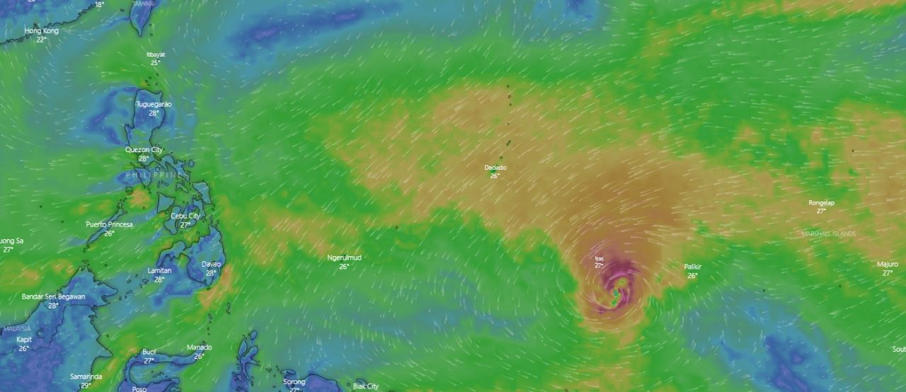
A low pressure area formed just south of the Marshall Islands on February 16. It then began to gradually organise while moving westward just south of Federated States of Micronesia. It was upgraded to a tropical depression by the JMA on February 18, with the JTWC following suit the following day.
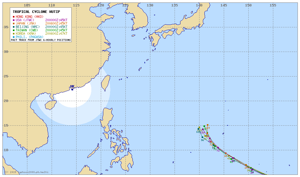
Today at 2:00 PM Philippines time, Tropical Storm WUTIP was located near 4.9°N 153.9°E. Maximum 10-minute sustained winds were at 45 knots (85 km/h; 50 mph), while maximum 1-minute sustained winds were at 45 knots (85 km/h; 50 mph), with gusts to 60 knots (110 km/h; 70 mph). The minimum central barometric pressure is 994 hPa, and the system is moving westward at 8 knots (15 km/h; 9 mph).
Just now at 06:00 PM the Japanese Meteorological Agency has upgraded WUTIP to Severe Tropical Storm.
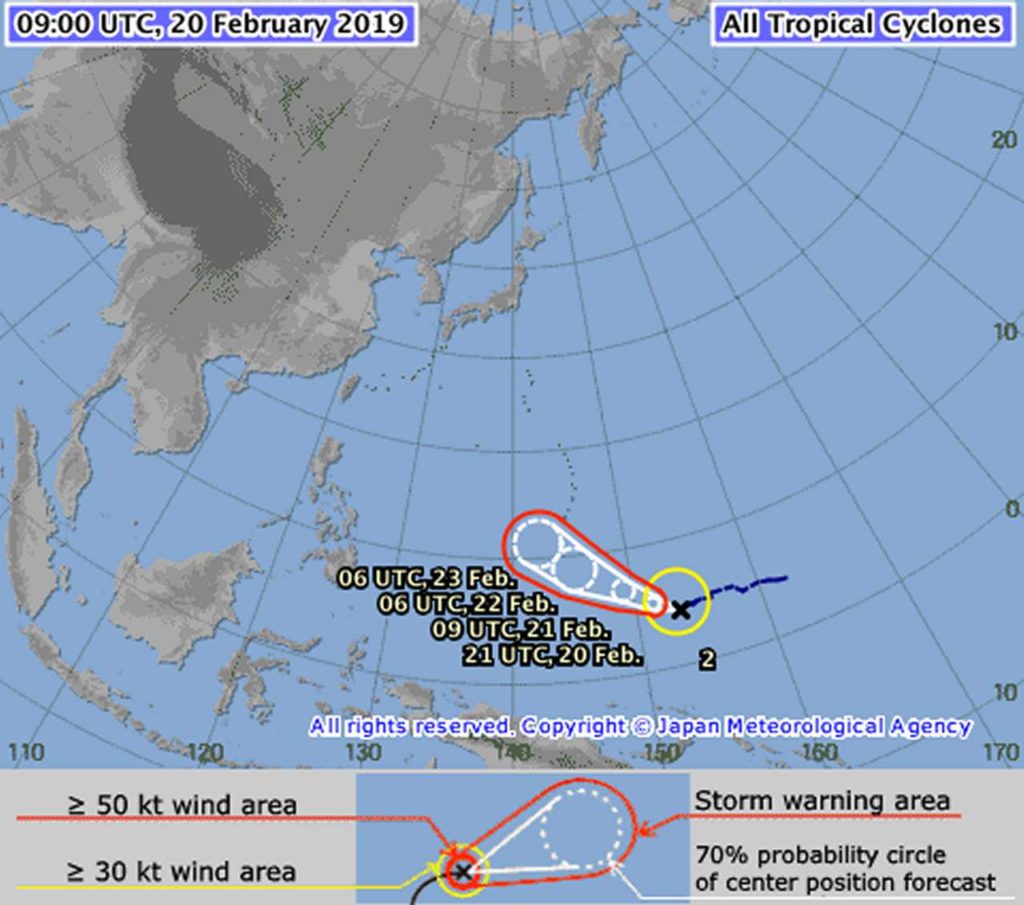
The next few days
Now First Typhoon 2019 WUTIP will quickly get stronger. JMA predicts a typhoon of category 3 within 2 days. The forecasts of all agencies are similar.
We’ll inform you if something should change. Otherwise you can follow WUTIP on our weather pages.
Related posts
 February 25, 2019 Typhoon WUTIP upgraded to Cat. 5 – moving towards Batanes Islands Typhoon WUTIP seemed to turn north before reaching the Philippines. It seemed even that it would dissolve before reaching Okinawa. But now […]
- January 11, 2015 AirAsia troubles
AirAsia is in troubles. After the regretful crash of AirAsia (Indonesia) flight QZ-8501 the sister company AirAsia-Zest (Philippines) […]
- July 31, 2013 Legazpi City and most Albay in the dark Since yesterday Legazpi City, 2 other cities and 15 towns of Albay are plunged into darkness.
The usually wonderful lights of […]
- February 9, 2017 Seven Philippine Cockatoos freed in Dumaran Island Seven Philippine Cockatoos (Katala) have been freed in Dumaran Island on January 27.
Philippine Cockatoos
Seven Philippine Cockatoos or […]
- September 26, 2015 Philippines’ negative image – new cases Philippines' negative image got worse this week. After last week's abduction of three foreign tourists on Samal island, the "Planted […]


Recent Comments