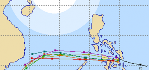
Tropical Storm WUKONG / Quinta moving towards Calamian Islands
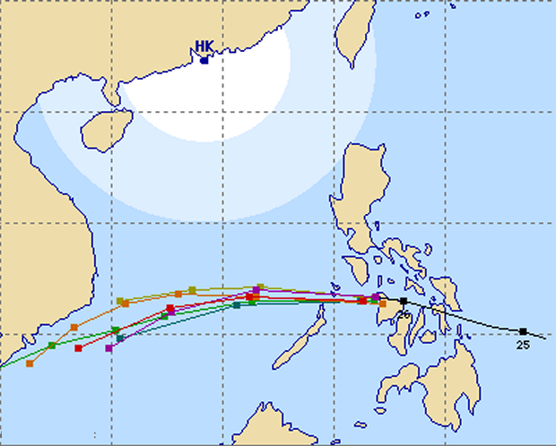
Tropical Storm WUKONG / Quinta passaed is now out in the Sulu Sea and moving towards the Calamian Islands at 22 km/h.
The storm has maintained its strength and may even get stronger again over water. This afternoon the positioning of the storm had been a bit confusing. It is not so easy to determine the center of an unorganized tropical storm.
All agencies forecast a western direction.

The JMA track is slightly more south. The storm might touch the northern end of Palawan.
Storm data:
| Name (INTL. / local): | WUKONG / Quinta |
| Class: | Tropical Storm |
| Time/Date of observation: | 06:00 PM on December 26, 2012 |
| Location of Center: | 11.7º North 121.0º East |
| Moving Direction and Speed: | West @ 22 km/h = 13 mph |
| Moving towards: | Calamian Islands |
| Distance from the Philippines: | inside |
| Estimated Date / Time of Landfall: | n/a |
| Max. Wind Speed near Center: | 65 km/h |
| Peak Wind Gusts: | 85 km/h |
| Minimum Central Pressure: | 996 hPa |
| Diameter: | 445 km |
| 24h Rainfall near Center: | 210 mm |
| Max. Wave Height: | 4 m = 14 ft |
Here you find how to read and understand this data  |
|
We are traveling. This is why we may not be able to follow the storm tomorrow.
Related posts
 December 26, 2012 Tropical Storm WUKONG / Quinta now approaching Boracay Tropical Storm WUKONG / Quinta passaed a bit more north than expected and is now in the vicinity of Boracay island.
The storm is moving […]
December 26, 2012 Tropical Storm WUKONG / Quinta now approaching Boracay Tropical Storm WUKONG / Quinta passaed a bit more north than expected and is now in the vicinity of Boracay island.
The storm is moving […]- December 26, 2012 Tropical Storm WUKONG / Quinta now over Bantayan Island Tropical Storm WUKONG / Quinta made landfall over Abuyog, Leyte at midnight. It continues moving over the Central Visayas and is now over […]
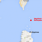
- September 7, 2013 Magnitude 6.0 Earthquake in the Batanes Islands Yesterday evening at 07:33:53 p.m. a Magnitude 6.0 Earthquake shook the Batanes Group of Islands between Luzon and Taiwan.
The Focus of […]
- June 19, 2014 Revised traffic violation fines Revised traffic violation fines takes effect today, June 19. Motorists and drivers especially in Metro Manila, Cebu and Davao, beware. The […]
- April 19, 2013 Cagayan de Oro Airport: WHEN ??? We informed you already yesterday that there is an information problem about the moving of Cagayan de Oro airport from Lumbia to […]


Recent Comments