Weather update – first serious warning
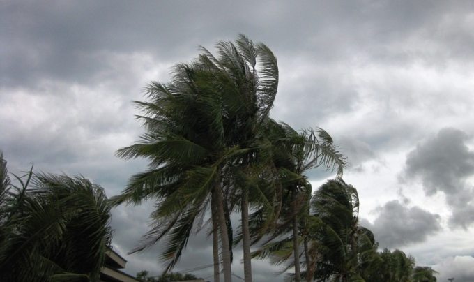
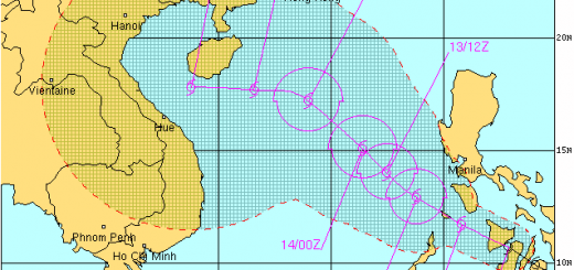
Weather update: The Low Pressure Area further approached the Philippines with an average forward speed of 15 kt = 28 km/h. The maximum sustained winds are estimated at 25 to 30 kt = 46 to 55 km/h. PAGASA gave this system the local name “Queenie”.
 |
Here is the Saffir-Simpson wind scale for you may see the related wind speed. I got a bit upset when PAGASA announced the LPA to be a Tropical Depression and 5 minutes later the whole facebook shouted TYPHOOOOOOON !If you look at the lowest classification, the Tropical Depression or TD, you see that there is now lower limit. So even if there is no wind, one can call this a Tropical Depression.And now let us quietly analyze the current situation. |
Weather update from JTWC (Joint Typhoon Warning Center)
We show the original warning from JTWC and insert our comments and explanation where needed.
ABPW10 PGTW 260600
MSGID/GENADMIN/JOINT TYPHOON WRNCEN PEARL HARBOR HI//
SUBJ/SIGNIFICANT TROPICAL WEATHER ADVISORY FOR THE WESTERN AND
/SOUTH PACIFIC OCEANS/260600Z-270600ZNOV2014//
SUBJ/TROPICAL CYCLONE FORMATION ALERT//
REF/A/JOINT TYPHOON WRNCEN PEARL HARBOR HI/260451Z NOV 14//
RMKS/
Above section says that the forecast is valid from November 26 2 p.m. to November 26 2 p.m. “Zulu” time is that which is more commonly know as “GMT” (Greenwich Mean Time) or UTC. The Philippine Standard Time is equal to Zulu + 8 hours
1. WESTERN NORTH PACIFIC AREA (180 TO MALAY PENINSULA):
A. TROPICAL CYCLONE SUMMARY: NONE.
There is no tropical cyclone
B. TROPICAL DISTURBANCE SUMMARY:
There is a tropical disturbance
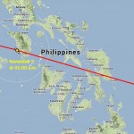
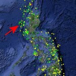
(1) THE AREA OF CONVECTION PREVIOUSLY LOCATED NEAR 9.4N
131.8E IS NOW LOCATED NEAR 8.5N 127.9E, APPROXIMATELY 550 NM
SOUTHEAST OF MANILA, PHILIPPINES.
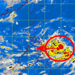
ANIMATED MULTISPECTRAL SATELLITE IMAGERY DEPICTS A
CONSOLIDATING LOW-LEVEL CIRCULATION CENTER (LLCC)
WITH FORMATIVE CONVECTIVE BANDING. A 260113Z METOP-A 89 GHZ IMAGE
INDICATES FRAGMENTED CONVECTIVE BANDING WRAPPING INTO THE DEFINED
LLCC, HOWEVER, LAND INTERACTION IS DISRUPTING BANDING OVER THE
WESTERN SEMI-CIRCLE. A 260027Z ASCAT IMAGE SHOWS 25 TO 30 KNOT WINDS
OVER THE EASTERN SEMI-CIRCLE. A 26/0300Z
Above text means that the Low Pressure Area has difficulties to get organized
SHIP OBSERVATION,
APPROXIMATELY 145 NM NORTH-NORTHWEST OF THE CENTER, INDICATES
EASTERLY WINDS AT 28 KNOTS. WITH THE EXCEPTION OF LAND INTERACTION,
THE ENVIRONMENT IS FAVORABLE WITH LOW VERTICAL WIND SHEAR AND GOOD
POLEWARD OUTFLOW. NUMERICAL GUIDANCE INDICATES THAT THE SYSTEM WILL
TRACK WESTWARD OVER MINDANAO OVER THE NEXT 12 TO 18 HOURS,
This is what we expected
RE-EMERGE OVER WATER BY TAU 24, AND INTENSIFY INTO A TROPICAL DEPRESSION BY
TAU 36. MAXIMUM SUSTAINED SURFACE WINDS ARE ESTIMATED AT 25 TO 30
KNOTS. MINIMUM SEA LEVEL PRESSURE IS ESTIMATED TO BE NEAR 1005 MB.
The LPA has a potential to become a Tropical Depression after having traversed Mindanao!
THE POTENTIAL FOR THE DEVELOPMENT OF A SIGNIFICANT TROPICAL CYCLONE
WITHIN THE NEXT 24 HOURS IS UPGRADED TO HIGH. SEE REF A (WTPN21 PGTW
Ok, it could get stronger, but after leaving Mindanao.
260500) FOR FURTHER DETAILS.
The rest is not interesting. The southern Pacific is calm
(2) NO OTHER SUSPECT AREAS.
2. SOUTH PACIFIC AREA (WEST COAST OF SOUTH AMERICA TO 135 EAST):
A. TROPICAL CYCLONE SUMMARY: NONE.
B. TROPICAL DISTURBANCE SUMMARY: NONE.//
NNNN
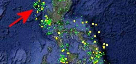
You may want to follow the weather in real time. Here are the 24 hour satellite loops.
The big question
Why is PAGASA making so much noise for a normal low pressure area?
SEVERE WEATHER BULLETIN NUMBER TWO
TROPICAL CYCLONE WARNING:TROPICAL DEPRESSION “QUEENIE”
Issued at 10:30 a.m., Wednesday 26 November 2014
[GARD]
Related posts
 November 7, 2013 PAGASA is back The PAGASA website is back, but extremely slow.
Also the Project NOAH website is on-line again.
November 7, 2013 PAGASA is back The PAGASA website is back, but extremely slow.
Also the Project NOAH website is on-line again.- November 7, 2013 Super Typhoon HAIYAN / Yolanda – PAGASA network overload When trying to connect to the PAGASA website, one only gets:
HTTP ERROR: 504
Gateway Timeout
RequestURI=http://www.pagasa.dost.gov.ph/
- August 22, 2013 Good sign or bad sign? During the last days PAGASA reported the filling status of the Luzon dams up to 8 times per day. This had been a very good service. But […]
- September 22, 2012 Tropical Storm “JELAWAT / Lawin” approching the Philippines Tropical Storm “JELAWAT / Lawin” has intensified. The outer rainbands already touch the eastern Philippine islands.
“JELAWAT / Lawin” is […]
- November 30, 2011 Strong Earthquakes in Zambales This morning the earth shook 4 times off the coast of Zambales. The first shock had a magnitude of 6.0 and could be felt in Metro Manila […]


Recent Comments