Flood warning
The active low pressure area east of the Philippines is expected to bring rain to the southern and central parts of the country.
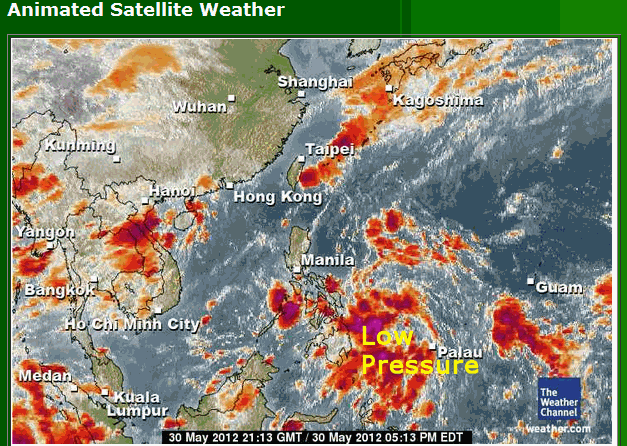
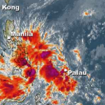
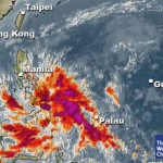
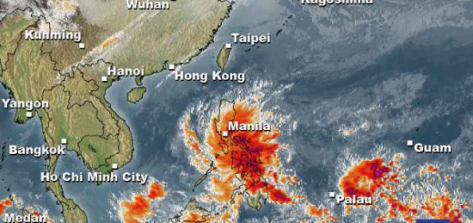
At 05:00 AM the active low pressure area was seen 410 kilometers east of Borongan, Eastern Samar embedded along the intertropical convergence zone affecting Southern Luzon, Visayas and Mindanao.

If the active low pressure area could further enhance the southwest monsoon, then the rainy season could officially be declared. Once it intensifies, the tropical depression will be named “Ambo,” the first tropical cyclone for 2012.
In its 5 a.m bulletin, the active low pressure area was seen 410 kilometers east of Borongan, Eastern Samar embedded along the intertropical convergence zone affecting Southern Luzon, Visayas and Mindanao.
Southern Luzon, Visayas and Mindanao will experience mostly cloudy skies with scattered rainshowers and thunderstorms becoming cloudy with widespread rains over the eastern section of Visayas and Mindanao which may trigger flashfloods and landslides.
Meanwhile, the rest of the country will have partly cloudy to cloudy skies with isolated rainshowers or thunderstorms. Light to moderate winds blowing from the north to northwest will prevail over Luzon and coming from the southwest to west over Visayas and Mindanao. The coastal waters throughout the archipelago will be slight to moderate.
Related posts
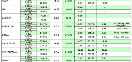
 September 4, 2013 Luzon Dams again under control Of the 9 dams in Luzon, 8 have closed their gates. Their water levels are between 10 centimeters overflow (Magat dam) and 18.9 meters […]
- July 3, 2012 The dams are full and Manila under water The dams in Luzon are full, very full, overflowing.
The La Mesa Dam in Quezon City has been placed on red alert status Tuesday morning. […]
- May 31, 2012 First Floods hit central Mindanao Floods destroy embankments of a river isolating some of the villages in San Fernando, Bukidnon on Tuesday. Intermittent rains triggered […]
- February 15, 2012 Floods in Mindanao – soon in the Southern Visayas The floods have begun. Near General Santos (Southern Mindanao) hundreds of houses in two major villages here were submerged in floodwaters […]
- February 15, 2012 La Niña brings rainy weather to the Visayas and Mindanao La Niña got stronger and brings waves of rainy weather to the Visayas and Mindanao.
This rain-map is allso available in an animated […]


Recent Comments