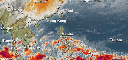
La Niña brings rainy weather to the Visayas and Mindanao
La Niña got stronger and brings waves of rainy weather to the Visayas and Mindanao.
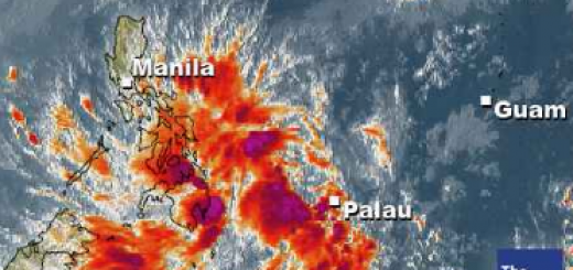
This rain-map is allso available in an animated form that allows to follow the progression 
The La Niña phenomenon got stronger in the last 2 weeks and has now an indicator of -1.0.

The animated La Niña map is here
Weather outlook:
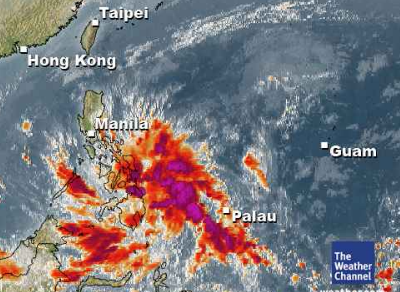
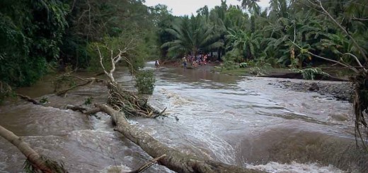
Southern Luzon, Bicol, Visayas and Mindanao will experience cloudy skies with scattered rain showers and thunderstorms with widespread rain over Eastern Visayas and Eastern Mindanao which may trigger flash floods and landslides.
The Philippine Atmospheric Geophysical and Astronomical Services Administration (PAGASA) also warned of flash floods and landslides over Bicol, Visayas and Mindanao.
Related posts
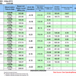
 September 4, 2013 Luzon Dams again under control Of the 9 dams in Luzon, 8 have closed their gates. Their water levels are between 10 centimeters overflow (Magat dam) and 18.9 meters […]
- July 3, 2012 The dams are full and Manila under water The dams in Luzon are full, very full, overflowing.
The La Mesa Dam in Quezon City has been placed on red alert status Tuesday morning. […]
- May 31, 2012 First Floods hit central Mindanao Floods destroy embankments of a river isolating some of the villages in San Fernando, Bukidnon on Tuesday. Intermittent rains triggered […]
- February 15, 2012 Floods in Mindanao – soon in the Southern Visayas The floods have begun. Near General Santos (Southern Mindanao) hundreds of houses in two major villages here were submerged in floodwaters […]
- February 13, 2012 Low Pressure Area brings heavy rains, floods and landslides The Low Pressure Area LPA 92W brings heavy rains, floods and landslides all over the southern islands of the Visayas.
PAGASA informed […]


Recent Comments