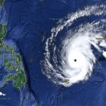
Typhoon MAYSAK/Chedeng – the last hours?

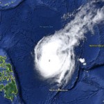
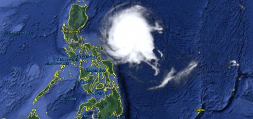
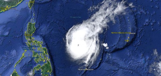
Typhoon MAYSAK/Chedeng showed a really strange behavior today. It changed its cloud shape from the usual typhoon doughnut to a pear and then an inverse comma. Being still a Typhoon Cat.2 it is continuing to loose its energy.
The colder waters over the northern Philippine Sea and the dryer air out-flowing from continental China deprived Typhoon MAYSAK/Chedeng of its primary energy resources. The cyclone is progressively decaying and will reach the northern Philippines on Sunday as a Tropical Storm.
The Forecast Tracks
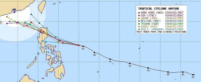
Funny: The PAGASA forecast track (blue) seems to have a data glitch – or maybe MAYSAK wants to meet P-Noy himself 😉
The northern end of Luzon will have a wet to flooded Easter Sunday. Please get prepared, observe rivers and be aware of possible landslides.
Typhoon MAYSAK/Chedeng Storm data
| Name (INTL. / local): | MAYSAK /Chedeng |
| Class: | Typhoon Cat.2 |
| Time/Date of observation: | 06:00 p.m. on April 3, 2015 |
| Location of Center: | 14.1º North 129.5.7º East |
| Moving Direction and Speed: | West @ 20 km/h |
| Moving towards: | Aurora-Isabela |
| Distance from the Philippines: | 640 km ENE of Legazpi |
| Estimated Date / Time of Landfall: | Sunday morning in Aurora-Isabela |
| Max. Wind Speed near Center: | 139 km/h |
| Peak Wind Gusts: | 185 km/h |
| Minimum Central Pressure: | 960 hPa |
| Diameter: | 500 km |
| 24h Rainfall near Center: | 50 – 300 mm |
| Max. Wave Height: | n/a |
| Here you find how to read and understand this data | |
Next update tomorrow morning.
Almost real-time storm information
The animated pictures of this violent storm are fascinating
[GARD]
Related posts
 April 4, 2015 Typhoon MAYSAK/Chedeng – now Category 1 Typhoon MAYSAK/Chedeng again got weaker last night but got a bit better organized. This makes us think that the storm will reach the coast […]
- April 3, 2015 Typhoon MAYSAK/Chedeng – weakening! Typhoon MAYSAK/Chedeng is progressively weakening. At this moment it has still category 2 strength. The storm is getting disorganized in […]
- April 2, 2015 Typhoon MAYSAK/Chedeng – appoaching Typhoon MAYSAK/Chedeng is still approaching. PAGASA and other government agencies start now to inform people. Don't mind this is the […]
- April 2, 2015 Typhoon MAYSAK/Chedeng now Cat.4 Typhoon MAYSAK/Chedeng continued to weaken while approaching the Philippines. Central pressure is now at 935 hPa. Forward speed slowed […]
- April 1, 2015 Typhoon MAYSAK/Chedeng – the Monster weakens Typhoon MAYSAK/Chedeng weakens. The monster storm lost a bit of its strength today but is still extremely strong. The central pressure […]


Recent Comments