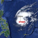
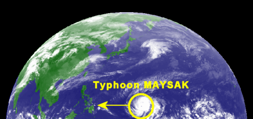
Typhoon MAYSAK/Chedeng – appoaching
Typhoon MAYSAK/Chedeng is still approaching. PAGASA and other government agencies start now to inform people. Don’t mind this is the Philippines.
For 5 days now we follow this cyclone (aka. typhoon or storm). But the authorities here in the Philipines start to warn people just now. There are 5 days lost. Why? We have put plywood on our windows. We have bought fuel for our generator. We have bought water and food. But what can people do in the touched regions, if the alert is coming too late? 5 days or 2 days? Why no earlier? You know: Bahala-na!
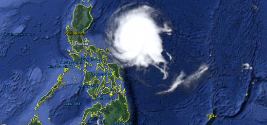
The Track Forecast
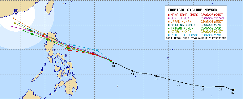
Heading towards the north of Luzon. Aurora will be hit on Sunday. Bicol seems to be off the track now.
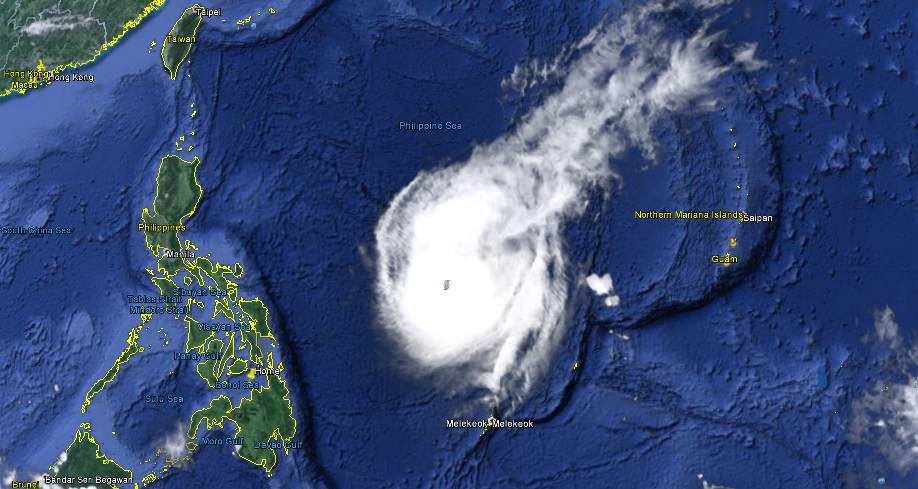
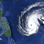
JMA reports a central pressure of 935 hPa. Wind speeds are 175 to 250 km/h. This is still very strong.
Typhoon MAYSAK/Chedeng Storm data
| Name (INTL. / local): | MAYSAK /Chedeng |
| Class: | Typhoon Cat.4 |
| Time/Date of observation: | 06:00 p.m. on April 2, 2015 |
| Location of Center: | 13.0º North 133.0º East |
| Moving Direction and Speed: | Northwest @ 15 km/h |
| Moving towards: | Aurora |
| Distance from the Philippines: | 880 km E of Virac |
| Estimated Date / Time of Landfall: | Sunday morning |
| Max. Wind Speed near Center: | 175 km/h |
| Peak Wind Gusts: | 250 km/h |
| Minimum Central Pressure: | 935 hPa |
| Diameter: | 800 km |
| 24h Rainfall near Center: | 50 – 300 mm |
| Max. Wave Height: | n/a |
| Here you find how to read and understand this data | |
Next update tomorrow maybe.
Almost real-time storm information
The animated pictures of this violent storm are fascinating
[GARD]
Related posts
 April 4, 2015 Typhoon MAYSAK/Chedeng – now Category 1 Typhoon MAYSAK/Chedeng again got weaker last night but got a bit better organized. This makes us think that the storm will reach the coast […]
- April 3, 2015 Typhoon MAYSAK/Chedeng – the last hours? Typhoon MAYSAK/Chedeng showed a really strange behavior today. It changed its cloud shape from the usual typhoon doughnut to a pear and […]
- April 3, 2015 Typhoon MAYSAK/Chedeng – weakening! Typhoon MAYSAK/Chedeng is progressively weakening. At this moment it has still category 2 strength. The storm is getting disorganized in […]
- April 2, 2015 Typhoon MAYSAK/Chedeng now Cat.4 Typhoon MAYSAK/Chedeng continued to weaken while approaching the Philippines. Central pressure is now at 935 hPa. Forward speed slowed […]
- April 1, 2015 Typhoon MAYSAK/Chedeng – the Monster weakens Typhoon MAYSAK/Chedeng weakens. The monster storm lost a bit of its strength today but is still extremely strong. The central pressure […]


Recent Comments