Five Low Pressure Areas in a row approaching the Philippines
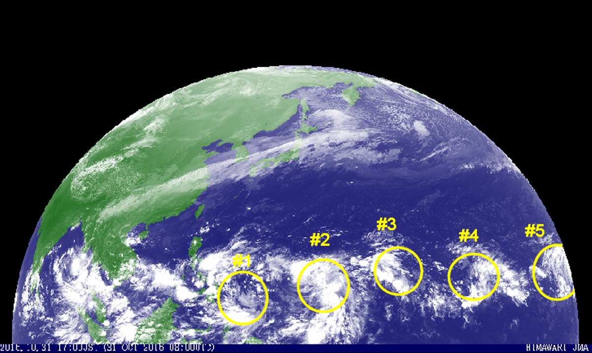
Five Low Pressure Areas in a row are approaching the Philippines. Today we observed five Low Pressure Areas (LPA) approaching the Philippines from east. Three of them are already rather near.
Habagat, the south-western monsoon has vanished. Currently the Easterlies, or north equatorial stream, is determining the weather in the Philippines. In about 3 weeks the north-east monsoon, the Amihan, will start to blow.
Five Low Pressure Areas
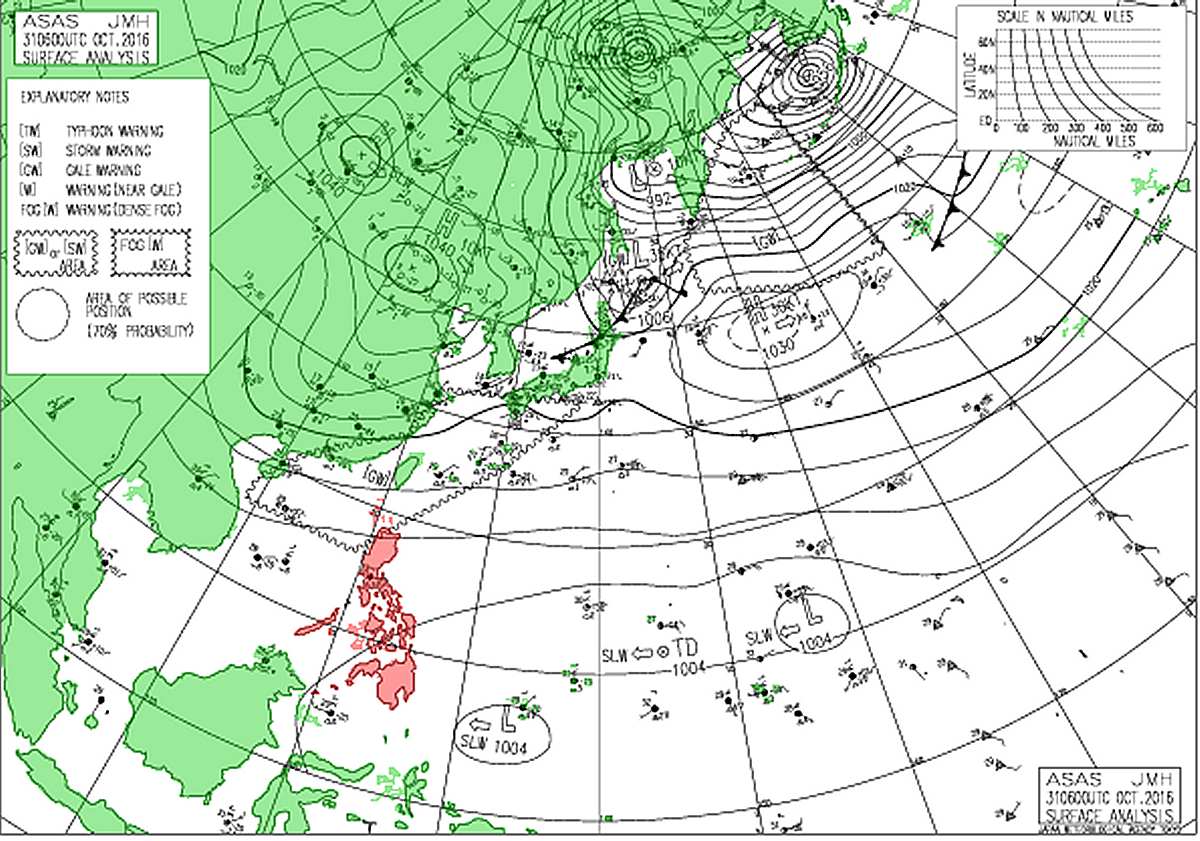
These LPA or Low Pressure Areas start developing over the Pacific Ocean. Many of them just start at the horizon of our satellite. The position is slightly west of Hawaii. The new Japanese weather satellite, Himawari-8 is operation and initiated is enhancing the quality and accuracy of our images. But also this satellite cannot pep over the horizon- Also the forecast of tracks of very far Low Prssure Areas is difficult to establish.
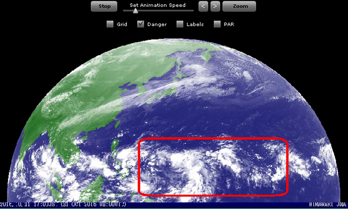
The Danger Zone
The picture below shows the danger zone. Low Pressure Areas within this red frame can develop into tropical cyclones which are may run over the Philippines.
#1 and #3 are still classified as LPA. #2 is already upgraded to a TD, a Tropical Depression. Number 1 is already too near to the Philippines and cannot become dangerous for islands.
But the other four need to be observed. Especially number 2 is already a well developed depression that can start to rotate at any moment and become a cyclone.
We strongly recommend to have an eye on the weather in the next days. The LPA will arrive in our region from 2 to 12 days. Depending on the atmospheric conditions, each one of them has the potential to become dangerous. These Five Low Pressure Areas could make the first half of November very rainy and rather grey.
Keep your eyes open!
Our 24 hours satellite image loops are here. And by the way, we are updating this last weather page. In the new version the animated satellite images will also be available on tablets and smartphones. Next week, maybe 😎
[GARD]
Related posts
 September 14, 2009 Manila NAIA: Radar down At 2:45 PM yesterday the Civil Aviation Authority of the Philippines (CAAP) issued a NOTAM, a notice to airmen.
NAIA General Manager […]
September 14, 2009 Manila NAIA: Radar down At 2:45 PM yesterday the Civil Aviation Authority of the Philippines (CAAP) issued a NOTAM, a notice to airmen.
NAIA General Manager […]- March 11, 2014 Hawksbill Sea Turtles in Camiguin Considered by many to be the most beautiful sea turtle for their colorful shells, the Hawksbill is found in tropical waters around the […]
- July 5, 2008 Cebu Pacific price increase Cebu Pacific Air informs that since July 1, 2008 the excess baggage fee has doubled from PHP 50 to PHP 100 per kilogram.
We do not yet […]
- September 17, 2013 Hassle free travel to Boracay Tourism in the Philippines still lacks of comfort. This not only means bad roads and murderous bus drivers, rusty ferries and endless fees […]
- March 30, 2015 Typhoon MAYSAK now Category 2 Typhoon MAYSAK got stronger and is now a Typhoon Category 2. The cyclone is continuing its westward track towards the Philippines at a […]


Recent Comments