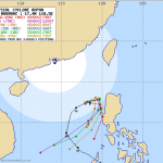
Oh no, Cyclone BOPHA/Pablo seems to come back
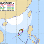
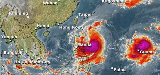
Cyclone BOPHA/Pablo is now a Severe Tropical Storm out in de West Philippine Sea. It has wind speeds of 95 to 120 km/h. This morning at 6 AM the storm was mowing at 11 km/h in direction North-Northwest.
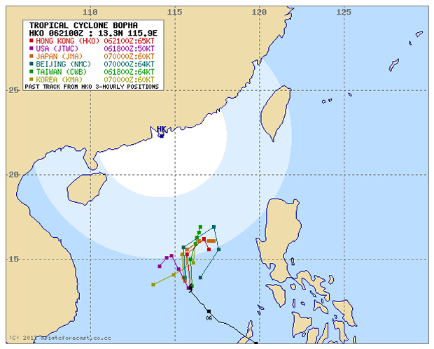
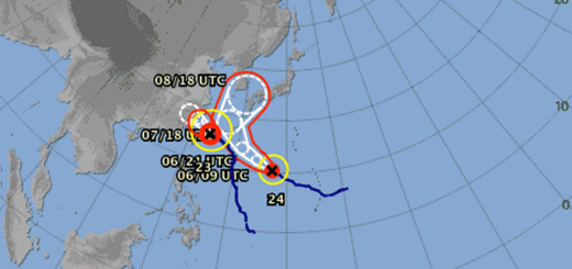
The multi-agency forecast looks like a kid had got a set of color-crayons. This reflects the different mathematical models used by the agencies. The US and the Koreans predict a movement to the west. All other agencies see the storm moving north to east.

JMA say that the strom will return and move towards Luzon
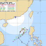
This behavior remembers typhoon Hagibis in November 2007. See also here 

Storm data:
| Name (INTL. / local): | BOPHA/Pablo |
| Class: | Severe Tropical Storm |
| Time/Date of observation: | 06:00 AM on December 07, 2012 |
| Location of Center: | 13.8º North 115.8º East |
| Moving Direction and Speed: | NNW @ 11 km/h |
| Moving towards: | ??? |
| Distance from the Philippines: | 497 km (WSW) from Subic Bay |
| Estimated Date / Time of Landfall: | ??? |
| Max. Wind Speed near Center: | 95 km/h |
| Peak Wind Gusts: | 120 km/h |
| Minimum Central Pressure: | 985 hPa |
| Diameter: | 445 km |
| 24h Rainfall near Center: | 450 mm |
| Max. Wave Height: | 5.5 m = 18 ft |
| Here you find how to read and understand this data |
|
Depending on the development of Typhoon BOPHA/Pablo we shall restart our reporting. We expect new information around 12:00 noon Philippines time (UTC 04:00).
Related posts
 December 8, 2012 Typhoon BOPHA/Pablo drives forecasters crazy – short update Typhoon BOPHA/Pablo is approaching northern Luzon. A final track cannot yet be seen. Track forecasts go from crossing Ilocos Norte to a […]
- December 8, 2012 Typhoon BOPHA/Pablo approaches Northern Luzon Typhoon BOPHA/Pablo is approaching northern Luzon. A final track cannot yet be seen. There are still too many parameters open for the […]
- December 8, 2012 Typhoon BOPHA/Pablo – the Movie We track the weather 7/24. if there is a dangerous situation, we inform our readers. One of our information sources is the Infrared (IR) […]
- December 8, 2012 Returning Typhoon BOPHA/Pablo is Category 3 now! Typhoon BOPHA/Pablo again got stronger and is now a Typhoon Category 3.
It is still hovering over the West Philippine Sea but has now […]
- December 7, 2012 Typhoon BOPHA/Pablo again got stronger – Category 2 now! Typhoon BOPHA/Pablo again got stronger and is again a Typhoon Cat.2.It is hovering over the West Philippine Sea. It's future direction […]


Recent Comments