Typhoon KOPPU/Lando brings first heavy rains

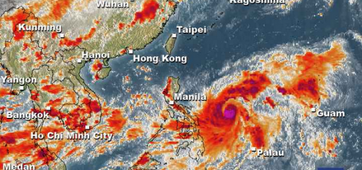
Typhoon KOPPU/Lando brings the first heavy rains to the Philippines. Winds on the north-east coast are now stronger than 30 knots (55 km/h). Big danger of landslides all over northern Luzon.
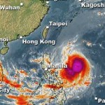
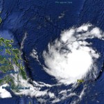
Cyclone KOPPU/Lando has gained strength last night. Its central pressure fell down to 960 hPa and wind speeds went up to 80 knots (150 km/h) near the centre and gusts can reach 115 knots (212 km/h). The typhoon is still heading west towards the costs of Aurora and Isabel provinces. Once it reaches Luzon, it will turn north-northwest and move up all northern Luzon. Rainfall is heavy to extreme, meaning 100 to 500 mm in 24 hours.
Danger of Landslides
The heavy to extreme rains accompanying Typhoon KOPPU/Lando will provoke landslides in the northern parts of Luzon.
WARNING
Avoid river beds and steep slopes. Observe the mountain and hill slopes. At the slightest movement leave the place immediately.
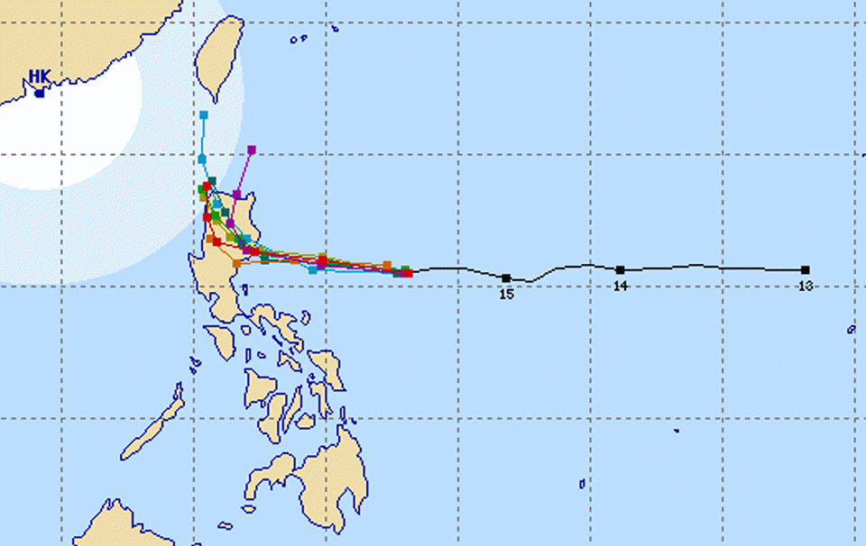
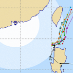
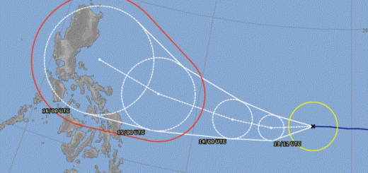
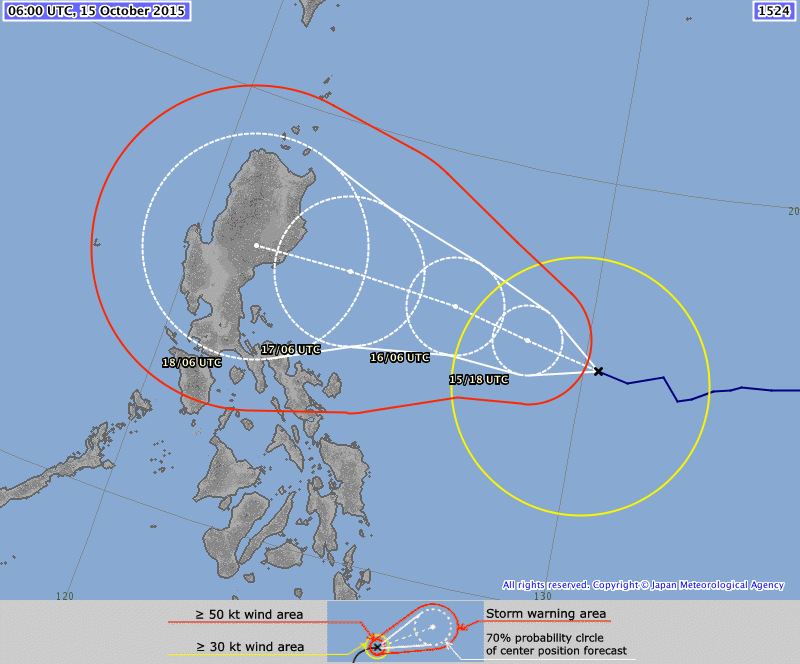
Typhoon KOPPU/Lando track forecast
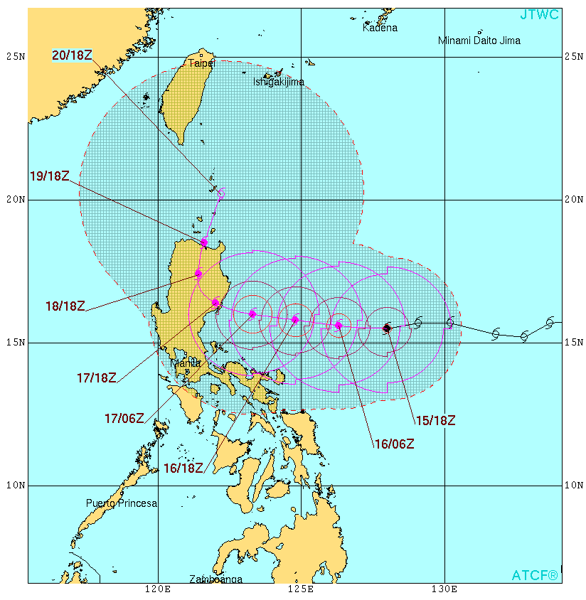 |
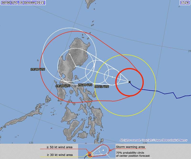 |
| Joint Typhoon Warning Center (JTWC) – click to enlarge | Japan Meteorological Agency (JMA) – click to enlarge |
KOPPU/Lando Storm data:
| Name (INTL. / local): | KOPPU/Lando |
| Class: | Typhoon Category 1 |
| Time/Date of observation: | 08:45 AM on October 16, 2015 |
| Location of Center: | 15.8° North 127.3° East |
| Moving Direction and Speed: | West @ 15 km/h |
| Moving towards: | Northern Luzon |
| Distance from the Philippines: | 620 km E of Baler (Aurora) |
| Estimated Date / Time of Landfall: | Sunday, Isabela/Aurora |
| Max. Wind Speed near Center: | 150 km/h |
| Peak Wind Gusts: | 212 km/h |
| Minimum Central Pressure: | 960 hPa |
| Diameter: | 550km |
| 24h Rainfall near Center: | 100 – 500 mm |
| Max. Wave Height: | 6-8 m Gale Warning |
| Here you find how to read and understand this data | |
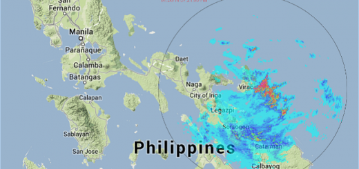
Nearly real-time storm information
Next update this afternoon.
[GARD]
Related posts
 October 18, 2015 Too slow! Typhoon KOPPU/Lando creeps over land Too slow! Typhoon KOPPU/Lando moves only very slowly northwest. Forward speeds are between 3 and 9 km/h! The Typhoon continues to bring […]
- October 16, 2015 Typhoon KOPPU/Lando is now affecting the Philippines Typhoon KOPPU/Lando is already near and upgraded to Cat.2. PAGASA sees it 510 km off the coast of Aurora. The strong winds and heavy […]
- May 7, 2015 Typhoon NOUL/Dodong now Cat.1 Typhoon NOUL/Dodong has gained strength and has entered PAR. The cyclone has turned northwest and has increased forward speed to 15 - 19 […]
- October 20, 2015 Cyclone KOPPU/Lando – full of surprises Cyclone KOPPU/Lando had been and still is full of surprises. First the good news - the storm is continuously weakening and it still stays […]
- October 18, 2015 Landfall over Casiguran – Aurora Super Typhoon KOPPU/Lando has made Landfall between Baler and Casiguran in Aurora province around 01:00 a.m. this morning. Cyclonic winds […]


Recent Comments