Storm UTOR / Labuyo is now a Typhoon Cat.1
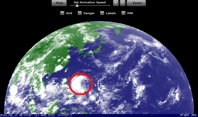
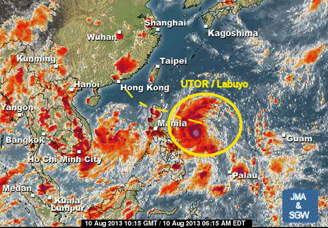
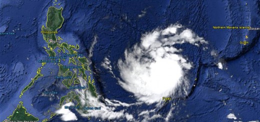
Typhoon UTOR / Labuyo has intensified all over the day and is now a Typhoon Category 1. It is running westwards at a speed of 26 km/h. The typhoon is expected to hit Luzon tomorrow.
Storm data:
| Name (INTL. / local): | UTOR / Labuyo |
| Class: | Typhoon Category 1 |
| Time/Date of observation: | 07:00 PM on August 10, 2012 |
| Location of Center: | 14.0º North 128.2º East |
| Moving Direction and Speed: | West @ 26 km/h (fast!) |
| Moving towards: | Aurora-Quirino Area |
| Distance from the Philippines: | 450 km from Virac, Catanduanes |
| Estimated Date / Time of Landfall: | Sunday night in Aurora-Quirino Area |
| Max. Wind Speed near Center: | 140 km/h |
| Peak Wind Gusts: | 165 km/h |
| Minimum Central Pressure: | 974 hPa |
| Diameter: | 445 km |
| 24h Rainfall near Center: | 250 mm |
| Max. Wave Height: | 7.2 m |
Here you find how to read and understand this data  |
|
Next update around 08:00 AM Sunday morning.






Recent Comments