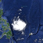
Typhoon NOUL/Dodong now Cat.1

Typhoon NOUL/Dodong has gained strength and has entered PAR. The cyclone has turned northwest and has increased forward speed to 15 – 19 km/h.
GDACS has issued a RED ALERT. Global Disaster Alert and Coordination System a joint operation of the United Nations and the European Commission.
The central pressure of Typhoon NOUL/Dodong has decreased from 976 hPa to 963 hPa. Wind speeds have increased from 110 to 140 km/h near the center and gusts now can reach 175 km/h. Rainfall has decreased to 100 – 300 mm in 24 hours.
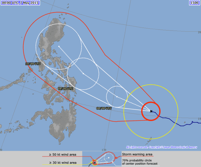
JMA predicts that the central pressure will go down to 935 hPa on Saturday. This means that the cyclone will be a Typhoon of Category 3 or 4 when it approaches Catanduanes and Caramoan.
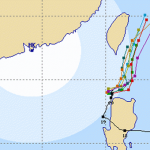
NOUL/Dodong Track Change
Most of the weather agencies in South East Asia have modified their track forecast for Typhoon NOUL/Dodong. Yesterday almost all tracks headed toward the Batanes Group of Islands. Today’s track forecast shows the correction southwards.
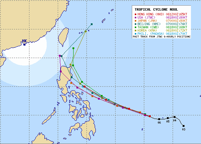
It could get rough for Catanduanes and Caramoan on Saturday afternoon or evening (May 9). The track change is due to a high pressure bridge over continental China. This high pressure areas of 1024 and 1032 hPa make pressure on the northern vector of Typhoon NOUL/Dodong.
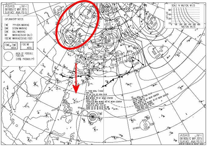
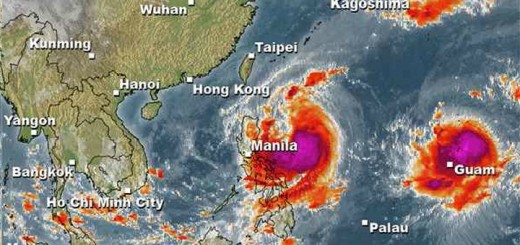
Above isobar map also shows already the next menace. There is a Tropical Depression (TD) building up behind Typhoon NOUL/Dodong. Unfortunately this TD has a rather good chance to develop also in a cyclone. We keep an eye on both of this whirling systems.
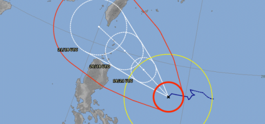
As usual we trust most in the JMA track forecast.
NOUL/Dodong Storm data:
| Name (INTL. / local): | NOUL / Dodong |
| Class: | Typhoon Category 1 |
| Time/Date of observation: | 05:00 AM on May 07, 2015 |
| Location of Center: | 10.5º North 134.3º East |
| Moving Direction and Speed: | West-Northwest @ 15 km/h |
| Moving towards: | Bicol Region |
| Distance from the Philippines: | 955 km ENE of Surigao |
| Estimated Date / Time of Landfall: | n/a |
| Max. Wind Speed near Center: | 140 km/h |
| Peak Wind Gusts: | 175 km/h |
| Minimum Central Pressure: | 963 hPa |
| Diameter: | 700 km |
| 24h Rainfall near Center: | 100 – 300 mm |
| Max. Wave Height: | 9 – 12 m |
| Here you find how to read and understand this data | |
Nearly real-time storm information
[GARD]
Related posts
 October 16, 2015 Typhoon KOPPU/Lando brings first heavy rains Typhoon KOPPU/Lando brings the first heavy rains to the Philippines. Winds on the north-east coast are now stronger than 30 knots (55 […]
- May 9, 2015 Typhoon NOUL/Dodong – off Bicol Typhoon NOUL/Dodong is now off the coast of Bicol and has been upgraded to a Category 3 Typhoon. The cyclone has gained a little bit of […]
- May 8, 2015 Typhoon NOUL/Dodong almost Cat. 3 Typhoon NOUL/Dodong has continued its approach to the Philippine islands as predicted. The cyclone got stronger but a bit smaller. Its […]
- May 7, 2015 Typhoon NOUL/Dodong short update Typhoon NOUL/Dodong is developing now quiet fast. It is already a Cat.2 Typhoon at a central pressure of 956 hPa. Its forward speed has […]
- October 20, 2015 Cyclone KOPPU/Lando – full of surprises Cyclone KOPPU/Lando had been and still is full of surprises. First the good news - the storm is continuously weakening and it still stays […]


Recent Comments