Typhoon BOPHA / Pablo – Update 07:30 AM on December 03, 2012
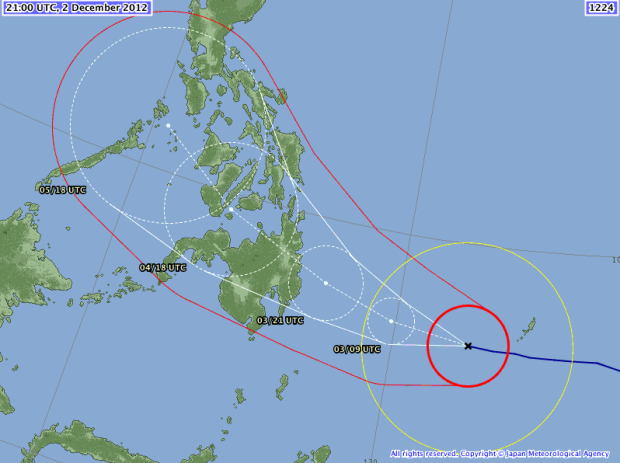
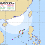
Typhoon Bopha (Pablo) is no longer a super typhoon as it moves quickly westward. It now threatens Surigao and Agusan Provinces. The possible landfall area is along the Bislig-Hinatuan Area on Tuesday morning.

The multi-agency forecast is now mostly uniform. The different forecast models converge.
JMA say that the strom will hit Surigao.
Storm data:
| Name (INTL. / local): | BOPHA / Pablo |
| Class: | Typhoon Category 4 |
| Time/Date of observation: | 06:00 AM on December 03, 2012 |
| Location of Center: | 6.7° North, 132.2° East |
| Moving Direction and Speed: | West @ 28 km/h = 17 mph |
| Moving towards: | Bislig |
| Distance from the Philippines: | 670 km from Bislig |
| Estimated Date / Time of Landfall: | ~ 07:00 AM on December 4, 2012 |
| Max. Wind Speed near Center: | 215 km/h = 133 mph |
| Peak Wind Gusts: | 260km/h = 161 mph |
| Minimum Central Pressure: | 937 hPa |
| Diameter: | 775 km = 482 mi |
| 24h Rainfall near Center: | 350 mm = 13.7 in |
| Max. Wave Height: | 15.8 m = 52 ft |
Here you find how to read and understand this data  |
|
PAGASA warnings and signals:
| Signal 1 30-60 km/h |
Signal 2 60-100 km/h |
Signal 3 100-185 km/h |
Signal 4 above 185 km/h |
| Surigao del Norte Siargao Island Dinagat Island Agusan del Norte Agusan del Sur Rest of Davao Oriental Davao del Norte Samal Island Compostela Vall. Bukidnon Misamis Occ. Misamis Oriental Camiguin Lanao del Norte Lanao del Sur |
Siquijor
Bohol
Biliran
Camotes Island
Southern Leyte
Leyte
Eastern Samar
Western SamarSurigao del Sur
Northern part of Davao Orientaln/an/aHere you find you find more information about the storm warning signals
Related posts
 December 8, 2012 Typhoon BOPHA/Pablo drives forecasters crazy – short update Typhoon BOPHA/Pablo is approaching northern Luzon. A final track cannot yet be seen. Track forecasts go from crossing Ilocos Norte to a […]
- December 8, 2012 Typhoon BOPHA/Pablo approaches Northern Luzon Typhoon BOPHA/Pablo is approaching northern Luzon. A final track cannot yet be seen. There are still too many parameters open for the […]
- December 8, 2012 Typhoon BOPHA/Pablo – the Movie We track the weather 7/24. if there is a dangerous situation, we inform our readers. One of our information sources is the Infrared (IR) […]
- December 8, 2012 Returning Typhoon BOPHA/Pablo is Category 3 now! Typhoon BOPHA/Pablo again got stronger and is now a Typhoon Category 3.
It is still hovering over the West Philippine Sea but has now […]
- December 7, 2012 Typhoon BOPHA/Pablo again got stronger – Category 2 now! Typhoon BOPHA/Pablo again got stronger and is again a Typhoon Cat.2.It is hovering over the West Philippine Sea. It's future direction […]


Recent Comments