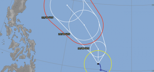
Typhoon Nepartak moving fast west-northwest towards Taiwan
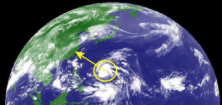
Typhoon Nepartak has been upgraded from a Tropical Storm to a Typhoon Cat.1. It is moving fast at 30 km/h towards Taiwan. Only the most northern islands of the Batanes group are within the storm warning zone.
The track forecasts for the next 2 days do not differ much. The US JTWC lays most east and the Hong Kong Observatory’s track is most west and forecasts that Typhoon Nepartak will hit Taiwan.
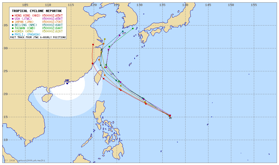
The JMA track of Typhoon Nepartak

The Batanes Islands will probably encounter rough weather this Thursday and Friday. The rest of the Philippines will see cloudy skies and some rain.
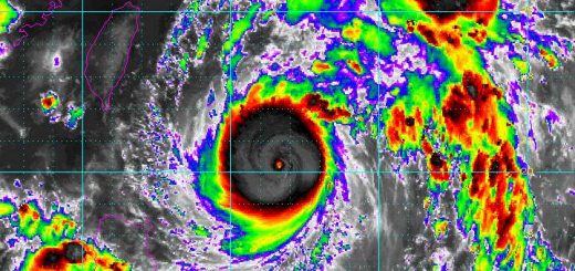
Nepartak Storm data:
| Name (INTL. / local): | NEPARTAK / – |
| Class: | Typhoon Cat.1 |
| Time/Date of observation: | 08:50 AM on July 05, 2016 |
| Location of Center: | 15.2º North 136.6º East |
| Moving Direction and Speed: | West-Northwest @ 30 km/h |
| Moving towards: | Taiwan |
| Distance from the Philippines: | 1,630 km E of Polillo Island |
| Estimated Date / Time of Landfall: | n/a |
| Max. Wind Speed near Center: | 130 km/h (70 kts) |
| Peak Wind Gusts: | 185 km/h (100 kts) |
| Minimum Central Pressure: | 970 hPa |
| Diameter: | 500 km |
| 24h Rainfall near Center: | 200 – 500 mm |
| Max. Wave Height: | 8 – 10 m |
| Here you find how to read and understand this data | |
Nearly real-time storm information
[GARD]
Related posts
 July 6, 2016 Super Typhoon NEPARTAK / Butchoy now Category 5 The first Typhoon of the Storm Season 2016 is a real Monster. Approaching the costs of Taiwan it now presents gust wind speeds of up to […]
- July 6, 2016 Ouverture furioso – Super Typhoon NEPARTAK / Butchoy The 2016 Typhoon Season starts with a Super Typhoon. Typhoon NEPARTAK / Butchoy has rapidly gained strength and is now a Super Typhoon […]
- July 21, 2014 Typhoon MATMO/Henry’s backdoor Typhoon MATMO/Henry seems to pass by. But even if it is not hitting the Philippine islands it is amplifying the south-west monsoon called […]
- July 18, 2014 Tropical Storm MATMO/Henry Tropical Storm MATMO/Henry has intensified as it entered PAR. Tropical Storm MATMO/Henry is expected to continue moving slowly […]
- September 2, 2013 Landslide – what landslide? It’s sunny in the Philippines People ask me often about our landslide warnings. Most tourists cannot imagine what it means. Landslide? What is sliding?
Our northern […]


Recent Comments