Typhoon MATMO/Henry’s backdoor
Typhoon MATMO/Henry seems to pass by. But even if it is not hitting the Philippine islands it is amplifying the south-west monsoon called Habagat. These winds can get rather strong.
Yesterday afternoon Habagat got extremely strong in the southern islands without being inside the typhoon’s circular winds. Here in Camiguin we had very strong winds and torrential rainfalls. And worse! In Agoho a local twister howled over the hills and the coast during ten minutes. It tore out nails from roofs and bent the coconut trees by 30 degrees and more. Fortunately no serious damages occurred.
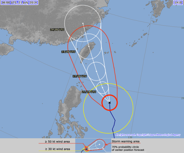
There is no high pressure area over mainland China that could push Typhoon MATMO/Henry more west. The very warm waters in the Philippine sea may amplify the storm on its way to Taiwan. Unfortunately the next LPA is already forming in the vicinity of Guam.
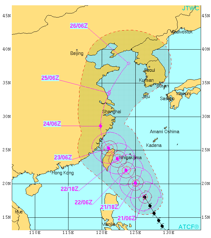
Probably north-east Taiwan will be victim of Typhoon MATMO/Henry. As a category 1 typhoon it will bring heavy rains that might cause landslides.
MATMA/Henry Storm data:
| Name (INTL. / local): | MATMA /Henry |
| Class: | Typhoon Cat.1 |
| Time/Date of observation: | 05:00 PM on July 20, 2014 |
| Location of Center: | 14.3º North 128.3º East |
| Moving Direction and Speed: | North-northwest @ 22 km/h |
| Moving towards: | Taiwan |
| Distance from the Philippines: | 420 km SE of Cagayan |
| Estimated Date / Time of Landfall: | n/a |
| Max. Wind Speed near Center: | 120 km/h |
| Peak Wind Gusts: | 150 km/h |
| Minimum Central Pressure: | 974 hPa |
| Diameter: | 700 km |
| 24h Rainfall near Center: | 150 – 400 mm |
| Max. Wave Height: | 10 – 12 m |
| Here you find how to read and understand this data | |
Nearly real-time storm information
[GARD]
Related posts
 July 6, 2016 Super Typhoon NEPARTAK / Butchoy now Category 5 The first Typhoon of the Storm Season 2016 is a real Monster. Approaching the costs of Taiwan it now presents gust wind speeds of up to […]
- July 6, 2016 Ouverture furioso – Super Typhoon NEPARTAK / Butchoy The 2016 Typhoon Season starts with a Super Typhoon. Typhoon NEPARTAK / Butchoy has rapidly gained strength and is now a Super Typhoon […]
- July 5, 2016 Typhoon Nepartak moving fast west-northwest towards Taiwan Typhoon Nepartak has been upgraded from a Tropical Storm to a Typhoon Cat.1. It is moving fast at 30 km/h towards Taiwan. Only the most […]
- November 18, 2014 Earthquakes – a strong series Earthquakes - a strong series shook the underground of the northern Philippines. Yesterday, 6 rather strong earthquakes rattled north of […]
- July 20, 2014 Typhoon MATMO/Henry amplifies Habagat Typhoon MATMO/Henry amplifies Habagat, the south-west monsoon. Here in Camiguin we had bad to nasty weather all day accompanied by the […]


Recent Comments