Weather gets ugly (update 06:00 PM)

Report from Typhoon2000.ph:
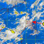
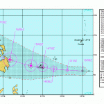
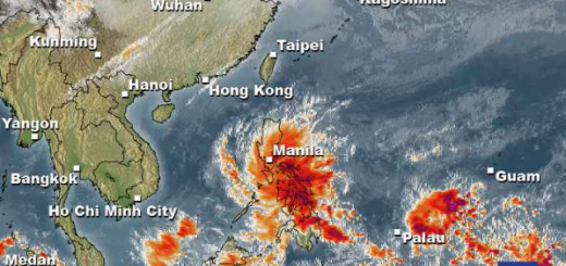
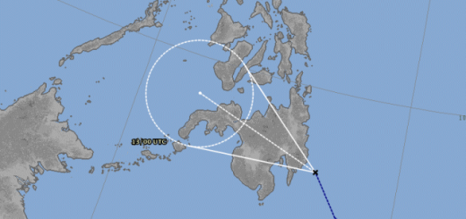
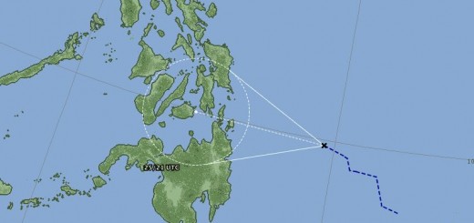
The strong Low Pressure Area (95W/1006 MB) continues to consolidate while over the Philippine Sea, east of Northern Samar and is likely to develop into a Tropical Depression within the next 12 to 24 hours.
The center was located about 353 km ENE of Borongan City or 505 km ESE of Virac, Catanduanes (12.1N 128.6E)…max winds of 35 kph…currently moving NW @ 22 kph towards Northeastern Luzon (Isabela-Cagayan Area).
Its thick and broad convective rainbands will bring scattered rains with squalls and thunderstorms across Eastern Mindanao & Eastern Visayas today.
Here in Camiguin the winds got stronger and the sky is covered with mid altitude clouds. We do not expect strong winds but heavy rains.
Related posts
 January 2, 2013 Depression – what depression – tropical depression The Low Pressure Area (LPA) 92W is now a Tropical Depression.
Here in Camiguin we had strong rains all the day and they continue.
There […]
January 2, 2013 Depression – what depression – tropical depression The Low Pressure Area (LPA) 92W is now a Tropical Depression.
Here in Camiguin we had strong rains all the day and they continue.
There […]- September 20, 2012 Tropical Depression “LAWIN” moving towards the Philippines While our friend David from Typhoon2000.com is on honeymoon leave, we observe the weather around the Philippines a bit closer.
There is a […]
- May 31, 2012 Weather gets ugly (update 09:00 PM) Last update today. The Japanese Meteorological Agency (JMA) has upgraded LPA 95W to Tropical Depression status.
The pressure in the […]
- December 13, 2011 Tropical Depression 27W approaching Tropical Depression 27W is approaching.
Tropical Depression 27W moves unusually low-south and directs to northern Minadanao and […]
- March 10, 2022 La Niña – the little girl continues peeing on the Philippines La Niña - the little girl continues peeing on the Philippines. ENSO and MJO play games with the southern Philippines. Instead of enjoying […]


Recent Comments