A hidden source of valuable information

What are the conditions of the roads in the Philippines?
Can I drive without problems from A to B?
Is the road in XYZ now a concrete road or do I still need a 4 wheeler?
Many, many people are asking these or similar questions. Everybody knows that the road system in the Philippines is exposed to weather and extra-heavy trucks. The results are potholes in series, broken concrete and swept away gravel roads.
When we travel around in the country, we always would like to know whether we can do a road with our car and at what average speed we might travel. Nothing is more uncomfortable than sleeping in car in a swamp away from a good food and a fine mattress.
A friend informed us recently about a very nice website that provides rather accurate information about the road conditions in a particular place.
It is the website of the The Department of Public Works and Highways (DPWH) 
Unfortunately the road information is not so easy to find and the title of these pages is a bit off-realty: 2011 DPWH Atlas. The maintenance projects 2012 and 2013 are already listed in this atlas.
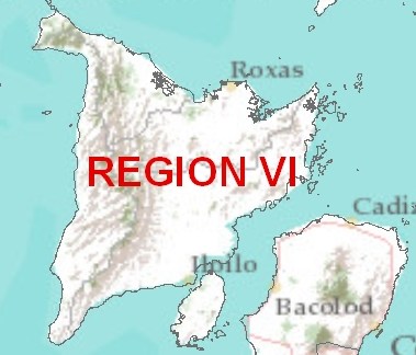
Let’s have a look. A frequently used road is the one from Kalibo airport to Caticlan (gateway to Boracay) in Aklan province on the island of Panay. The first challenge is to find Aklan province. If you do not know that Aklan is in Region VI, you will have to have a look in the atlas overview  .
.
Then you can go to the top of the page and may click on the Region VI button.
You get a big map of the whole Region VI. Unfortunately the names of the provinces are printed in a not easily readable color on the map. You have to search a bit.
You have to know the province’s name. Otherwise you would not be able to click on the corresponding button on the top of the page. When there are different engineering districts like the 4 in Iloilo province, you have to try. Only Engineers know their districts  .
.
When you hit on the Aklan button, you will finally get your desired information.
 Click on above map to enlarge.
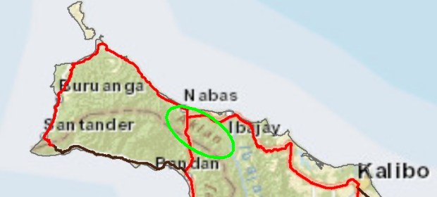
The colors of the roads and the kilometer indications give you a first hint about the road conditions. Most of our sample road from Kalibo to Caticlan is green, meaning in good conditions. There are some small spots in yellow color. This shouldn’t make troubles, because yellow still means fair conditions. But there is a stretch in orange color between Tangalan and Ibajay. Here you might have to wait or drive very slowly.
You see that the length of the stretch is about 5km.
The legend of the map informs you also about the surface type: Concrete, Asphalt, Gravel or Earth. In the lower part of the same page you get more information about the length of the particular condition. Our stretch between Tangalan and Ibajay is marked 2 – 2. But we have not yet decrypted what means from K0234+-905 to K0275+659. Do you have an idea?
The latest crucial information is not easy to find. The question is “How long will these maintenance work last?”
To find this information, you have to go back to the first page and click on Infrastructure in the left hand menu. On the Infrastructure page you have to click on Region VI in the map called R VI. You then get a very long table with all the infrastructure projects in Region VI.
Hint: You can use your browser’s search function and type there “Ibajay”.
Here we learn, that our repair stretch is already 100% complete since mid April 2012 and, just for fun, that the repair budget of 10,000,000 pesos had not been entirely used up. 8,999,000 pisos only. 
We wish you happy browsing and finding the road you plan to drive.


last day`s we had heavy rains on our island. when we drove with our car on a road, normally full of holes, we made a experience like a miracle: all holes was gone ! we had a plane road!
what looks like a miracle, is very simple: the rainwater filled up all the holes.
means, we wait for more rain and then walang problema with holes and cracks in the road !
joke lang
juanpedfro