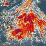
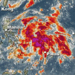
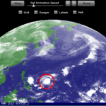
As predicted, the Low Pressure Area over the Philippine Sea has changed its moving direction and is now heading north to northwest at 15 km/h.
Its current center position is 628 km East of Legazpi City. The central pressure is steady at 1006 hPa. Peak winds are 30 km/h.
Eastern Visayas, Northern Mindanao and Zamboanga Peninsula will experience cloudy skies with moderate to occasionally heavy rains and thunderstorms.
Heavy rains may trigger flashfloods and landslides.
Calabarzon, Mimaropa, Bicol Region and the rest of Visayas and of Mindanao will have cloudy skies with light to moderate rain showers and thunderstorms.
Metro Manila and the rest of Luzon will be partly cloudy to cloudy with isolated rain showers or thunderstorms mostly in the afternoon or evening.
There is no imminent danger.
So, have a nice day. 
Related posts
 June 6, 2013 Low Pressure Area is growing and intensifying The Low Pressure Area (LPA) called 97W is growing and intensifying.
The pressure inside the system went down to 1006 hPa. The LPA is […]
 June 6, 2013 Weather could get nasty A Low Pressure Area (LPA) called 97W has formed east of the Philippines.
Its pressure is still high (1008 hPa) and it is not yet […]
 November 25, 2014 Weather update southern Philippines Weather update southern Philippines: A weak Low Pressure Area (LPA) is approaching Surigao. We expect cloudy to rainy weather for […]
 July 24, 2014 2 Low Pressure Areas queuing up 2 Low Pressure Areas queuing up for the Philippines. The two LPAs 96W and 98W are slowly moving westwards. They are still weak with 1006 […]
 April 20, 2014 New Tropical Depression forming A new Tropical Depression (LPA 98W) is forming east of Palau. The TD is slowly moving westwards, towards the Philippines.
Weather is […]





Recent Comments