Tropical Storm 27W (pre Sendong) is aproaching
Tropical Storm 27W / pre Seendong
The Tropical Depression 27W has been upgraded to Tropical Storm . Once it will be inside PAR* it will be given the name Sendong).
* PAR = Philippines Area of Responsibility
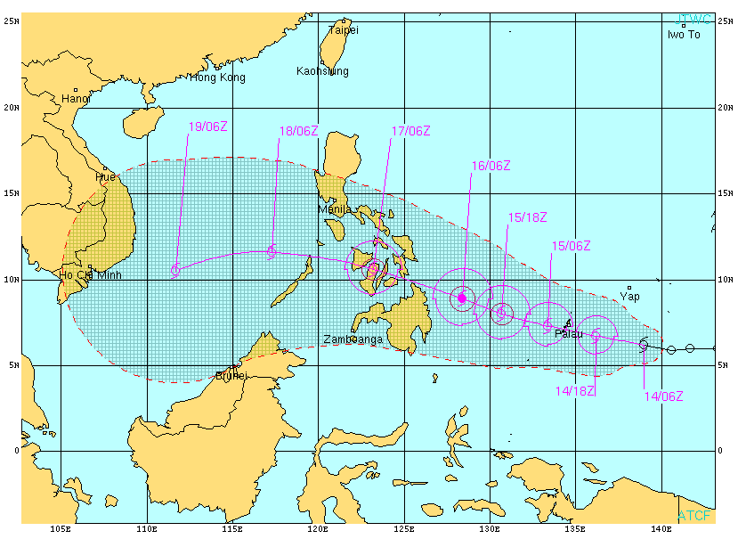
The US Navy forecast
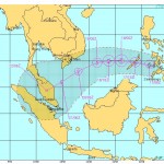
The PAGASA forecast
Not yet available because outside PAR
PAGASA STROM SIGNALS
No storm signals yet.
CURRENT STORM INFORMATION 27W / Sendong
| Time/Date: | 05:00 PM Wednesday December 14, 2011 |
| Location of Center: | 6.3º N Latitude, 138.3º E Longitude |
| Distance: | 365 km East of PAR |
| MaxWinds: | 65 km/h (35 kts) near the center |
| Peak Wind Gusts: | 85 km/h (45 kts) |
| Present Movement: | West at 30 km/h (16 kts) |
| Towards: | Surigao |
| Expected Landfall: | Saturday early morning [01:00 to 02:00 AM] |
| 24hr Rainfall: | 250 mm |
| Minimum Central Pressure: | 996 millibars (hPa) |
| Size: | n/a |
| Max Wave Height: | 4 m (12 ft) |
Near real time weather information is here 
Next storm update tomorrow around 12:00 PM (12:00) UTC+8
Related posts
 December 17, 2011 Tropical Storm WASHI / Sendong now heading towards Palawan Tropical Storm WASHI / Sendong left Mindanao after leaving hundreds of dead in the cities of Cagayan de Oro and Iligan. It is approaching […]
- December 16, 2011 Tropical Storm WASHI / Sendong continues toward Bukidnon and Iligan Tropical Storm WASHI / Sendong follows its track over Central Mindano. Its moving direction west to north-west will bring it to Bukidnon […]
- December 16, 2011 Tropical Storm WASHI / Sendong has made landfall Tropical Storm WASHI / Sendong had made landfall already around 2:30 PM near Baganga, Davao Oriental. The storm continues on its western […]
- December 16, 2011 Tropical Storm WASHI / Sendong on the coast of Mindanao Tropical Storm WASHI / Sendong has slowed down its west movement to 24 km/h. This is why landfall will be later than expected. PAGASA has […]
- December 16, 2011 News Ticker: Quiet After having "saved" the Lady Julia, our workers went home to secure their own houses. We do not expect a heavy storm but strong rainfall. […]


Recent Comments