Tropical Storm WASHI / Sendong is a straight runner
Tropical Storm WASHI / Sendong is a straight runner. The weather agencies did correct its forecast track nearly every hour. They also had problems to predict the strength. But now the track and the strenght are well defined.
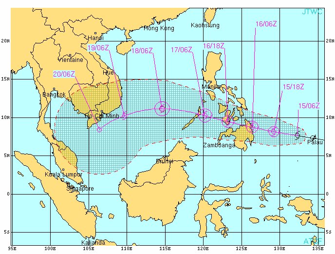
The US Navy forecast
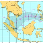
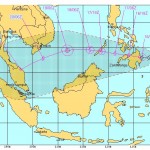
The PAGASA forecast

PAGASA STROM SIGNALS
Storm Signal 1 (45-60 km/h):
– Eastern Samar
– Surigao Del Norte
– Siargao Island
– Surigao Del Sur
– Dinagat Province
– Agusan Provinces
– Misamis Oriental
– Western Samar
– Leyte Provinces
– Camotes Island
– Bohol
CURRENT STORM INFORMATION: WASHI / Sendong
| Time/Date: | 06:00 PM Thursday December 15, 2011 |
| Location of Center: | 7.7º N Latitude, 131.3º E Longitude |
| Distance: | 641 km ESE of Butuan City |
| MaxWinds: | 65 km/h (35 kts) near the center |
| Peak Wind Gusts: | 85 km/h (45 kts) |
| Present Movement: | West at 37 km/h (20 kts) |
| Towards: | Surigao |
| Expected Landfall: | Saturday early morning [00:00 to 01:00 AM] |
| 24hr Rainfall: | 120 mm |
| Minimum Central Pressure: | 996 millibars (hPa) |
| Size: | 500 km (270 nm) |
| Max Wave Height: | 5.5 m (16 ft) |
Near real time weather information is here 
Next storm update tomorrow around 12:00 PM (12:00) UTC+8
Related posts
 December 17, 2011 Tropical Storm WASHI / Sendong now heading towards Palawan Tropical Storm WASHI / Sendong left Mindanao after leaving hundreds of dead in the cities of Cagayan de Oro and Iligan. It is approaching […]
- December 16, 2011 Tropical Storm WASHI / Sendong continues toward Bukidnon and Iligan Tropical Storm WASHI / Sendong follows its track over Central Mindano. Its moving direction west to north-west will bring it to Bukidnon […]
- December 16, 2011 News Ticker: No more rain but wind The rain stopped at 04:00 PM (16:00). Now the wind started to blow from north-east with about 30 to 40 km/h. The waves got a bit higher […]
- December 16, 2011 Tropical Storm WASHI / Sendong has made landfall Tropical Storm WASHI / Sendong had made landfall already around 2:30 PM near Baganga, Davao Oriental. The storm continues on its western […]
- December 16, 2011 News Ticker: Rainy and gray, that’s all Nothing special to report. It slightly rains from a uniform gray sky.
Landfall is postponed to 3:00 PM this afternoon. We now have a […]


Recent Comments