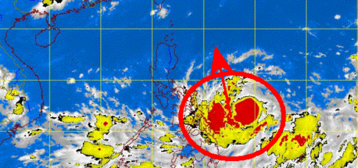
Tropical Storm WASHI / Sendong on the coast of Mindanao
Tropical Storm WASHI / Sendong has slowed down its west movement to 24 km/h. This is why landfall will be later than expected. PAGASA has put all southern islands under signal 1 or 2.
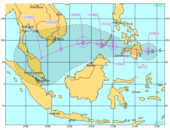
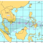
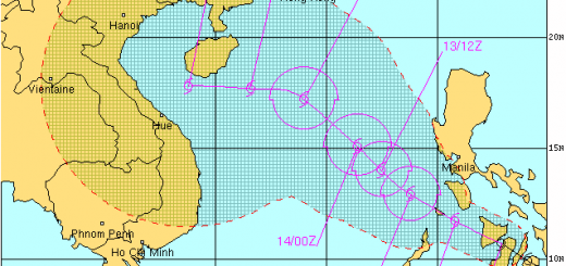
The US Navy forecast
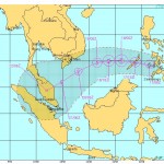
The PAGASA forecast

PAGASA STROM SIGNALS
Storm Signal 2 (60-100 km/h winds):
– Southern Leyte
– Bohol
– Southern Cebu
– Southern Negros
– Siquijor Island
– Surigao Del Norte
– Siargao Island
– Surigao Del Sur
– Dinagat Province
– Agusan Provinces
– Davao del Norte
– Davao Oriental
– Samal Island
– Lanao Provinces
– Misamis Provinces
– Zamboanga Provinces
– North Cotabato
– Compostela Valley
– Bukidnon
– Camiguin
– Maguindanao
Storm Signal 1 (45-60 km/h winds):
– Palawan
– Cuyo Island
– Eastern Samar
– Western Samar
– Northern Leyte
– Northern Cebu
– Northern Negros
– Iloilo
– Capiz
– Antique
– Aklan
– Guimaras Province
– Davao Del Sur
– Sultan Kudarat
– South Cotabato
– Sarangani Province
– Basilan Province
CURRENT STORM INFORMATION: WASHI / Sendong
| Time/Date: | 12:00 noon Friday December 16, 2011 |
| Location of Center: | 7.6º N Latitude, 127.2º E Longitude |
| Distance: | 119 km SE of Bislig City |
| MaxWinds: | 85 km/h (45 kts) near the center |
| Peak Wind Gusts: | 100 km/h (55 kts) |
| Present Movement: | West at 24 km/h (13 kts) |
| Towards: | Davao Oriental and Surigao Del Sur Area |
| Expected Landfall: | TODAY [14:00 to 15:00] |
| 24hr Rainfall: | 205 mm |
| Minimum Central Pressure: | 989 millibars (hPa) |
| Size: | 500 km (270 nm) |
| Max Wave Height: | 5.6 m (17 ft) |
Near real time weather information is here 
Next storm update today around 4:00 PM (16:00) UTC+8
Related posts
 December 16, 2011 Tropical Storm WASHI / Sendong has made landfall Tropical Storm WASHI / Sendong had made landfall already around 2:30 PM near Baganga, Davao Oriental. The storm continues on its western […]
- December 16, 2011 Tropical Storm WASHI / Sendong goes more South Tropical Storm WASHI / Sendong passes more south than expected. Latest forecast tracks show the storm moving over northern Central […]
- December 17, 2011 Tropical Storm WASHI / Sendong now heading towards Palawan Tropical Storm WASHI / Sendong left Mindanao after leaving hundreds of dead in the cities of Cagayan de Oro and Iligan. It is approaching […]
- December 16, 2011 Tropical Storm WASHI / Sendong continues toward Bukidnon and Iligan Tropical Storm WASHI / Sendong follows its track over Central Mindano. Its moving direction west to north-west will bring it to Bukidnon […]
- December 16, 2011 News Ticker: No more rain but wind The rain stopped at 04:00 PM (16:00). Now the wind started to blow from north-east with about 30 to 40 km/h. The waves got a bit higher […]


Recent Comments