Tropical Storm KOPPU/Lando a bit slower
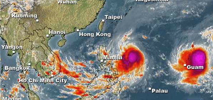
Tropical Storm KOPPU/Lando advanced a bit slower than forecasts predicted. While still moving westward it gained a bit of strength. The circular motion is not yet stable.
The winds around the centre are now more than 55 knots (100 km/h). Gusts go up to 80 knots (150 km/h). This is just 8 knots below Typhoon Cat.1. And these are the good news: This storm will reach a maximum of Cat.3. And instead of Saturday, it will arrive o the coasts of Isabela or Aurora on Sunday morning. This gives som additional hours to the people to get prepared.
The second storm, CHAMPI, should start its northward turn tomorrow evening. On the satellite photos it looks more menacing, but it won’t hit the Philippines.
Current weather: Most islands encounter cloudy skies. This goes of slightly scattered clouds to rainy weather.
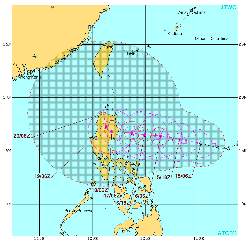
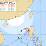
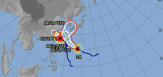
Tropical Storm KOPPU/Lando track forecast
 |
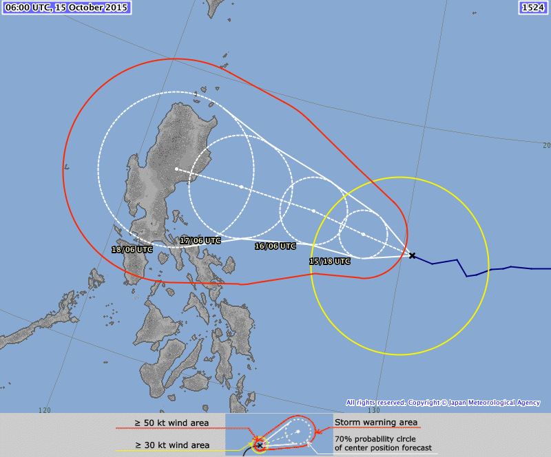 |
| Joint Typhoon Warning Center (JTWC) – click to enlarge | Japan Meteorological Agency (JMA) – click to enlarge |
KOPPU/Lando Storm data:
| Name (INTL. / local): | KOPPU/Lando |
| Class: | Tropical Storm |
| Time/Date of observation: | 05:45 PM on October 14, 2015 |
| Location of Center: | 15.4° North 129.5° East |
| Moving Direction and Speed: | West @ 17 km/h |
| Moving towards: | Northern Luzon |
| Distance from the Philippines: | 1093 km E of Casiguran |
| Estimated Date / Time of Landfall: | Sunday, Isabela/Aurora |
| Max. Wind Speed near Center: | 100 km/h |
| Peak Wind Gusts: | 150 km/h |
| Minimum Central Pressure: | 985 hPa |
| Diameter: | 550km |
| 24h Rainfall near Center: | 100 – 500 mm |
| Max. Wave Height: | 6-8 m Gale Warning |
| Here you find how to read and understand this data | |
Nearly real-time storm information
Next update tomorrow.
[GARD]
Related posts
 October 14, 2015 Tropical Storm KOPPU/Lando straight westward Tropical Storm KOPPU/Lando continues on its westward track. It has slightly slowed down the forward speed from 25 to 20 km/h. It has […]
- October 6, 2014 Typhoons – still lucky Philippines Typhoon season 2014 started in April with Tropical Storm PEIPAH / Domeng. Since then already 17 cyclones crossed over the waters of the […]
- December 9, 2012 Typhoon BOPHA/Pablo – the final movie We track the weather 7/24. If there is a dangerous situation, we inform our readers. One of our information sources is the Infrared (IR) […]
- December 8, 2012 Typhoon BOPHA/Pablo drives forecasters crazy – short update Typhoon BOPHA/Pablo is approaching northern Luzon. A final track cannot yet be seen. Track forecasts go from crossing Ilocos Norte to a […]
- December 8, 2012 Typhoon BOPHA/Pablo approaches Northern Luzon Typhoon BOPHA/Pablo is approaching northern Luzon. A final track cannot yet be seen. There are still too many parameters open for the […]


Recent Comments