Tropical Storm RAMMASUN / Glenda
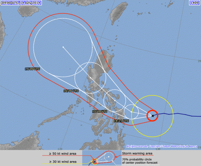
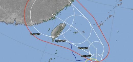
Tropical Storm RAMMASUN has entered PAR and got the Filipino name “Glenda”. Tropical Storm RAMMASUN/Glenda is a “straight runner” and has maintained its westward track. The landfall will be much more south in the Bicol region.
The typhoon will hit Catanduanes in a few hours and move over Caramoan towards Naga City. Our family in Naga City informed us, that they went to save houses far from the river. The roofs should be OK. It’s a Cat. 1 typhoon with a lot of rain but average wind speed.
Tomorrow morning the typhoon will be more weak when it will be over Manila.
Rammasun Storm data:
| Name (INTL. / local): | RAMMASUN / Glenda |
| Class: | Typhoon Cat. 1 |
| Time/Date of observation: | 06:30 PM on July 14, 2014 |
| Location of Center: | 12.7º North 128.7º East |
| Moving Direction and Speed: | West-Southwest @ 22 km/h |
| Moving towards: | Bicol |
| Distance from the Philippines: | 495 km ESE of Virac, Catanduanes |
| Estimated Date / Time of Landfall: | Wednesday, early afternoon |
| Max. Wind Speed near Center: | 120 km/h |
| Peak Wind Gusts: | 150 km/h |
| Minimum Central Pressure: | 974 hPa |
| Diameter: | 520 km (small) |
| 24h Rainfall near Center: | 200 – 350 mm |
| Max. Wave Height: | n/a |
| Here you find how to read and understand this data | |
Nearly real-time storm information
[GARD]





Recent Comments