Typhoon SOULIK/Huaning still got weaker
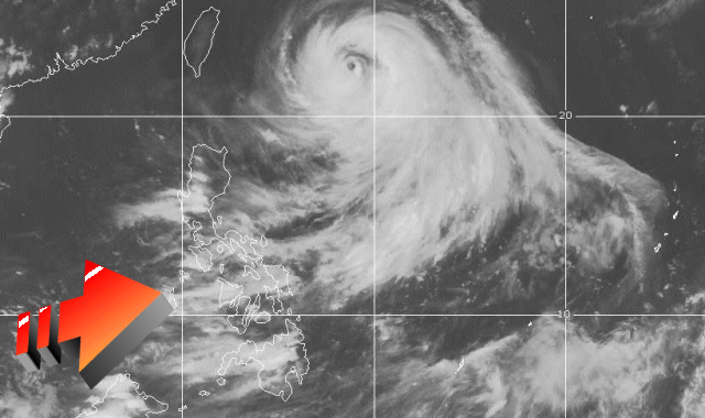
Typhoon SOULIK/Huaning has maintained its weakening trend as well as its westerly motion during the past 6 hours. There is still an important danger for Yaeyama Islands and Taiwan. Typhoon SOULIK/Huaning is now classified as a Typhoon Category 2.
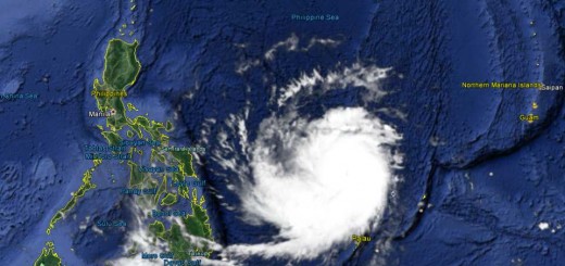
The typhoon is now 745 km ENE of Basco, Batanes. This are about 300 km more distance than the first forecasts announced. But all Philippine Islands will still feel the passing by typhoon because it enhances the south-western monsoon (Habagat). Please see the clouds in the satellite picture below.

Our new weather forecast got a bit disturbed. We get strange data that does not match with the current situation. Batanes islands are even off-line. Please check the data for your place and report strange behavior. Salamat po.

Related posts
 July 10, 2013 Typhoon SOULIK/Huaning has entered PAR The Powerful Typhoon SOULIK / 07W has entered the northeastern border of the Philippine Area of Responsibility (PAR) and got the local […]
- November 18, 2015 Tropical Storm IN-FA moving west Tropical Storm IN-FA is moving west. This storm is still far away from the Philippines but has the potential to amplify to a Typhoon Cat. […]
- October 15, 2015 Tropical Storm KOPPU/Lando a bit slower Tropical Storm KOPPU/Lando advanced a bit slower than forecasts predicted. While still moving westward it gained a bit of strength. The […]
- October 14, 2015 Tropical Storm KOPPU/Lando straight westward Tropical Storm KOPPU/Lando continues on its westward track. It has slightly slowed down the forward speed from 25 to 20 km/h. It has […]
- October 13, 2015 Two Tropical Depressions in a row Two Tropical Depressions in a row are approaching the Philippines. The nearer one at 142° E, is moving westward at 15 km/h. The second one […]


Recent Comments