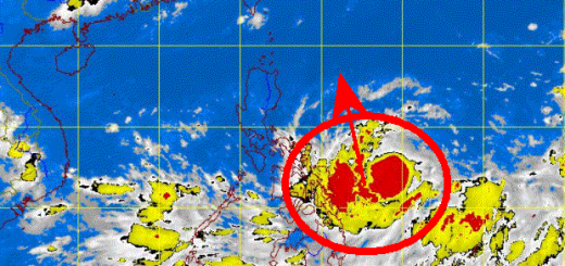
HAGUPIT/Ruby – slowed down and weakened

Typhoon HAGUPIT/Ruby has slowed down its forward speed from 30 km/h to only 15 km/h. The typhoon also weakened a bit and is now a Typhoon Category 4. This change is due to the constantly weakening High Pressure Areas (HPA) over continental China.
The weakening is more than welcome. Central pressure increased to 925 hPa this afternoon around 3 p.m. Slowing down the forward speed gives evacuation teams a bit more time. But on the other hand the typhoon will remain a longer time in the same place and bring much higher quantities of torrential rainfall.
Tourists Warning
The airlines have already begun to cancel flights. If you have a flight booked until next Tuesday or Wednesday, get in contact with your airline. Philippine Airlines has already cancelled 26 flights. Cebu Pacific Air is at 48 flights. No news from AirAsia/Zest.
The Multi-Agency Tracks
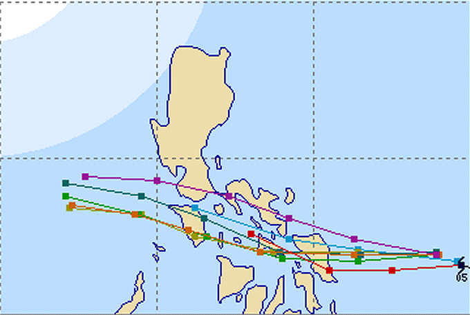
The US Navy (JTWC) in violet is still most northern and removes the immediate danger from Samar.
All other agencies still predict a landfall in Samar. Hong-Kong (red) is the southernmost track.
Panay also seems to escape the worst impact, instead the typhoon will hit Masbate and then Mindoro.
JMA Typhoon track forecast
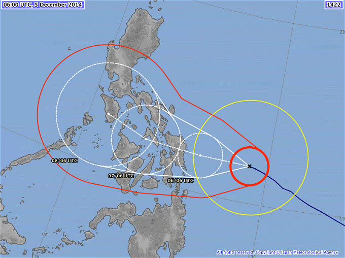
JMA has corrected the strict western track into a slightly west-northwest direction. They still predict a faster forward movement than JTWC.
Isobars – pressure map
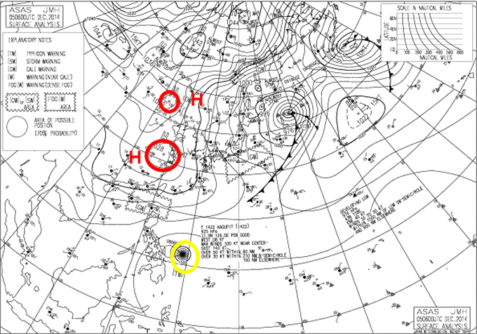
The red circles show the weakening High Pressure Areas over continental China. They are responsible for the more northern track of Typhoon HAGUPIT/Ruby (yellow).
Typhoon HAGUPIT/Ruby Storm data
(update 8:00 p.m.)
| Name (INTL. / local): | HAGUPIT/Ruby |
| Class: | Typhoon Cat.4 |
| Time/Date of observation: | 08:00 PM on December 5, 2014 |
| Location of Center: | 12.0º North 128.7º East |
| Moving Direction and Speed: | West @ 10 km/h |
| Moving towards: | Norther Samar / Sorsogon |
| Distance from the Philippines: | 345 km ENE of Guiuan, Samar |
| Estimated Date / Time of Landfall: | Late Saturday, Early Sunday |
| Max. Wind Speed near Center: | 185 km/h |
| Peak Wind Gusts: | 260 km/h |
| Minimum Central Pressure: | 929 hPa |
| Diameter: | 975 km |
| 24h Rainfall near Center: | 150 – 500 mm |
| Max. Wave Height: | 8 – 12 m |
| Here you find how to read and understand this data | |
Next update tomorrow morning.
Almost real-time storm information
[GARD]
Related posts
 December 6, 2014 Typhoon HAGUPIT/Ruby 6 p.m. update Typhoon HAGUPIT/Ruby is continuously approaching Samar. JMA classifies the typhoon as "very strong" this means still Cat.4. The expected […]
- December 5, 2014 HAGUPIT/Ruby – short update 9 p.m. Typhoon HAGUPIT/Ruby again intensifying and moving towards Samar - JMA has again updated their forecast - Data from 8:40 p.m.(PST) - […]
- December 7, 2014 Typhoon HAGUPIT/Ruby – slow – slow – slow Typhoon HAGUPIT/Ruby is moving very slowly over the Visayas. With an average forward speed of 10 km/h the typhoon will need about 56 hours […]
- June 10, 2016 Phreatic Explosion on Bulusan Volcano A Phreatic Explosion happened on Bulusan Volcano at 11:35 a.m. on June 10. Mount Bulusan in Sorsogon province spewed ashes 2000 meters […]
- February 25, 2016 Bulusan volcano is nervous – PHIVOLCS is investigating Bulusan volcano is nervous - A team from the Philippine Institute of Volcanology and Seismology (PHIVOLCS) central office will be in […]


Recent Comments