MATMO Henry could become dangerous

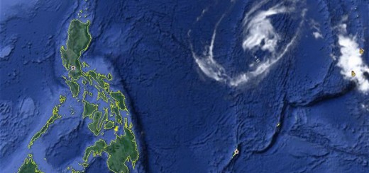
Tropical Storm MATMO/Henry continued on a nearly westward track and approached the Philippine islands during the last 24 hours. This morning the center was at 645 km east-northeast of Siargao Island. Tropical Storm MATMO/Henry is intensifying.
Tropical Storm MATMO/Henry troubles forecasters. Instead of moving straight north, it moved westward. You may want to compare with yesterday’s forecast …
Yesterday’s forecast is right, today’s forecast is left.
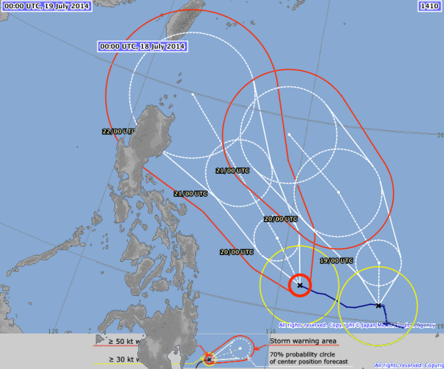
Tropical Storm MATMO/Henry not only moved westward, it also got much stronger. The central pressure of the system went down from 996 to 985 hPa. Windspeeds increased from 65 km/h to 101 km/h near the center. Gustiness is now up at 148 km/h. Al storm data comes from JMA.
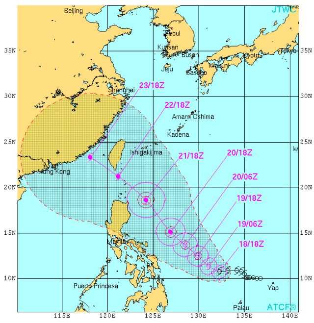
The US navy forecast is a bit less menacing for the Philippines. But also the navy predicts that the storm will hit the Batanes Islands.
We just received a red alert from GDACS. GDACS is a cooperation framework between the United Nations, the European Commission and disaster managers worldwide to improve alerts, information exchange and coordination in the first phase after major sudden-onset disasters.
MATMA/Henry Storm data:
| Name (INTL. / local): | MATMA /Henry |
| Class: | Tropical Storm |
| Time/Date of observation: | 05:00 AM on July 19, 2014 |
| Location of Center: | 11.2º North 131.0º East |
| Moving Direction and Speed: | West @ 25 km/h |
| Moving towards: | Batanes Islands |
| Distance from the Philippines: | 655 km ENE of Surigao |
| Estimated Date / Time of Landfall: | n/a |
| Max. Wind Speed near Center: | 101 km/h |
| Peak Wind Gusts: | 148 km/h |
| Minimum Central Pressure: | 985 hPa |
| Diameter: | 445 km |
| 24h Rainfall near Center: | 200 – 450 mm |
| Max. Wave Height: | n/a |
| Here you find how to read and understand this data | |
Nearly real-time storm information
[GARD]
Related posts
 December 1, 2014 Warning: Tropical Storm 22W is developing quickly This morning we announced that a new Low Pressure Area is developing. This LPA developed extremely fast during the day and has already […]
- July 18, 2014 Tropical Storm MATMO/Henry Tropical Storm MATMO/Henry has intensified as it entered PAR. Tropical Storm MATMO/Henry is expected to continue moving slowly […]
- November 18, 2015 Tropical Storm IN-FA moving west Tropical Storm IN-FA is moving west. This storm is still far away from the Philippines but has the potential to amplify to a Typhoon Cat. […]
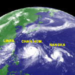
- July 8, 2015 CHAN-HOM and NANGKA – Habagat Amplifiers Last weekend, Tropical Storm LINFA/Egay brought a lot of rain over northern Luzon. Now it is enhancing the southwest monsoon (Habagat) […]
- May 10, 2015 Tropical Storm DOLPHIN – The next bad guy? You may remember our storm report from May 8. We then reported a strange guy developing around Palikir, Micronesia. This strange guy now […]


Recent Comments