Tropical Storm WUKONG / Quinta is on forecast track
Tropical Storm WUKONG / Quinta intensified again. It seems to keep “on-track” moving towards the central Visayas.
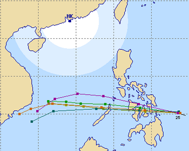
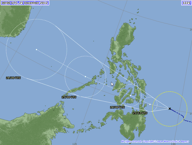
Forecast models show that the storm will follow its track from southern Leyte passing over northern Negros and then over southern Panay.
Again, the danger isn’t the wind but the extreme masses of water it will carry over and on the islands. Be careful, friendly creeks and mountain streams may become flooding torrents.
The multi-agency forecast has nearly not changed.
JMA say that the strom will hit Dinagat, southern Leyte, Cebu City northern Negros and southern Panay.
Storm data:
| Name (INTL. / local): | WUKONG / Quinta |
| Class: | Tropical Storm |
| Time/Date of observation: | 05:00 PM on December 25, 2012 |
| Location of Center: | 10.3º North 126.5º East |
| Moving Direction and Speed: | West @ 24 km/h = 14 mph |
| Moving towards: | Visayas |
| Distance from the Philippines: | 90 km Southeast of Guiuan, Eastern Samar |
| Estimated Date / Time of Landfall: | 10:00 PM on December 25, 2012 |
| Max. Wind Speed near Center: | 75 km/h |
| Peak Wind Gusts: | 90 km/h |
| Minimum Central Pressure: | 997 hPa |
| Diameter: | 445 km |
| 24h Rainfall near Center: | 350 mm |
| Max. Wave Height: | 4 m = 13 ft |
Here you find how to read and understand this data  |
|
Next update tomorrow morning or as soon as we get new data.







Recent Comments