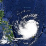
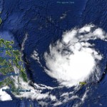
Typhoon NOUL/Dodong almost Cat. 3

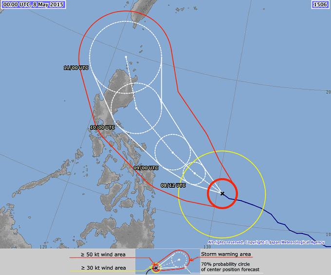
Typhoon NOUL/Dodong has continued its approach to the Philippine islands as predicted. The cyclone got stronger but a bit smaller. Its current diameter is estimated at 640 km. Upgrade to category 3 will happen this morning.
Typhoon NOUL/Dodong is expected to continue moving west-northwestward and then gradually turning to northwest. The cyclone will traverse the south-central part of the Philippine Sea today through Saturday morning and shall be passing near the northeastern coast of Catanduanes by Saturday afternoon and evening. It is expected that the storm will gain strength again and will be upgraded to a Typhoon Category 4.
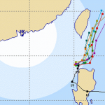
NOUL/Dodong all tracks come very close

All forecast track are very near to each other. But forecasters assign a low confidence level for Sunday and following days. This is due to the weak pressure gradients over continental China. We expect that above map will change significantly within the next 48 hours.
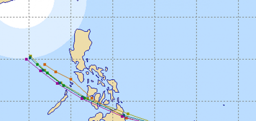
The Track
PAGASA has now assigned storm signal #1 for:
Catanduanes, Camarines Norte, Camarines Sur, Albay, Sorsogon, Polillo Island and Northern Samar
NOUL/Dodong Storm data:
| Name (INTL. / local): | NOUL / Dodong |
| Class: | Typhoon Category 2 – 3 |
| Time/Date of observation: | 05:00 AM on May 08, 2015 |
| Location of Center: | 11.9º North 130.3º East |
| Moving Direction and Speed: | West @ 20 km/h |
| Moving towards: | Bicol Region |
| Distance from the Philippines: | 670 km ESE of Sorsogon City |
| Estimated Date / Time of Landfall: | n/a |
| Max. Wind Speed near Center: | 175 km/h |
| Peak Wind Gusts: | 215 km/h |
| Minimum Central Pressure: | 950 hPa |
| Diameter: | 640 km |
| 24h Rainfall near Center: | 100 – 300 mm |
| Max. Wave Height: | 9 – 12 m |
| Here you find how to read and understand this data | |
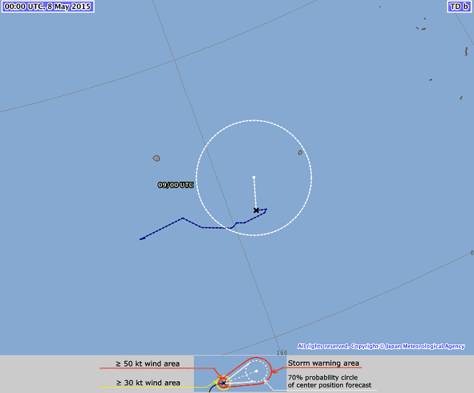
A strange guy out there
About 4 degrees north and 160 degrees east hovers a strange guy. The Tropical Depression 07W has slowly moved eastwards during the last days. It is “swimming” against the stream. But now it is turning north and is expected to turn even northwest while gaining strength.
Nearly real-time storm information
[GARD]
Related posts
 May 9, 2015 Typhoon NOUL/Dodong – off Bicol Typhoon NOUL/Dodong is now off the coast of Bicol and has been upgraded to a Category 3 Typhoon. The cyclone has gained a little bit of […]
- May 7, 2015 Typhoon NOUL/Dodong short update Typhoon NOUL/Dodong is developing now quiet fast. It is already a Cat.2 Typhoon at a central pressure of 956 hPa. Its forward speed has […]
- May 7, 2015 Typhoon NOUL/Dodong now Cat.1 Typhoon NOUL/Dodong has gained strength and has entered PAR. The cyclone has turned northwest and has increased forward speed to 15 - 19 […]
- October 20, 2015 Cyclone KOPPU/Lando – full of surprises Cyclone KOPPU/Lando had been and still is full of surprises. First the good news - the storm is continuously weakening and it still stays […]
- October 18, 2015 Too slow! Typhoon KOPPU/Lando creeps over land Too slow! Typhoon KOPPU/Lando moves only very slowly northwest. Forward speeds are between 3 and 9 km/h! The Typhoon continues to bring […]


Recent Comments