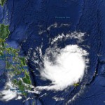
Typhoon NOUL/Dodong – off Bicol
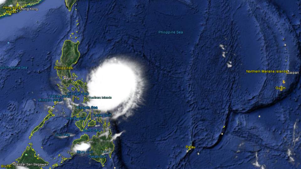
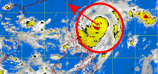
Typhoon NOUL/Dodong is now off the coast of Bicol and has been upgraded to a Category 3 Typhoon. The cyclone has gained a little bit of strength when it moved on a generally northwesterly track.
Here in Camiguin we have sunny weather but no electricity. Fortunately the solar panels produce enough power, so I can write this newest report. The central pressure of Typhoon NOUL/Dodong has further decreased from 950 to 944 hPa.Wind speed has increased from 175 to 185 km/h near the center. Gusts are now up to 220 km/h.
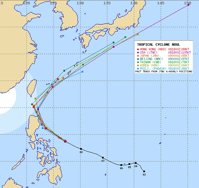
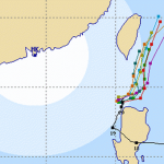
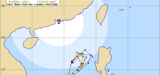
NOUL/Dodong all tracks
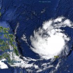
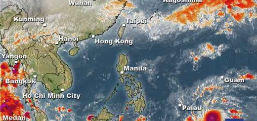
There is a real chance that Typhoon NOUL/Dodong will pass by northern Luzon and later will touch the Batanes Group of Islands. The pressure distribution over continental China is extremely fragile. The famous butterfly flying up from a flower in Hong Kong could move the typhoon by many kilometers.
The Track
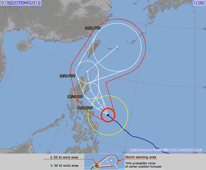
JMA predicts that the cyclone will get stronger today and will become a Typhoon Category 4 by this afternoon. At this moment the 50 kt wind area around the center will grow larger. Event without landfall, the coasts of Isabela will encounter high waves and very strong winds.
PAGASA declares the following storm signals:
Storm Signal #3 (winds of 121- 170 km/h):
– Cagayan
– Isabela
– Northern Aurora
Storm Signal #2 (winds of 61- 120 km/h):
– Calayan and Babuyan Group of Island
– Apayao, Kalinga
– Mt. Province
– Nueva Vizcaya
– Ifugao
– Rest of Aurora
– Polillo Island
– Catanduanes-
– Qurino
NOUL/Dodong Storm data:
| Name (INTL. / local): | NOUL / Dodong |
| Class: | Typhoon Category 3 |
| Time/Date of observation: | 05:00 AM on May 09, 2015 |
| Location of Center: | 13.6º North 137.5º East |
| Moving Direction and Speed: | West @ 20 km/h |
| Moving towards: | Nort-East Luzon |
| Distance from the Philippines: | 360 km ESE of Pandan, Catanduanes |
| Estimated Date / Time of Landfall: | Sunday evening |
| Max. Wind Speed near Center: | 185 km/h |
| Peak Wind Gusts: | 220 km/h |
| Minimum Central Pressure: | 944 hPa |
| Diameter: | 500 km |
| 24h Rainfall near Center: | 50 – 200 mm |
| Max. Wave Height: | 7 – 10 m |
| Here you find how to read and understand this data | |
Nearly real-time storm information
Next update as soon as we have again power here in Camiguin.
[GARD]
Related posts
 May 8, 2015 Typhoon NOUL/Dodong almost Cat. 3 Typhoon NOUL/Dodong has continued its approach to the Philippine islands as predicted. The cyclone got stronger but a bit smaller. Its […]
- May 7, 2015 Typhoon NOUL/Dodong short update Typhoon NOUL/Dodong is developing now quiet fast. It is already a Cat.2 Typhoon at a central pressure of 956 hPa. Its forward speed has […]
- May 7, 2015 Typhoon NOUL/Dodong now Cat.1 Typhoon NOUL/Dodong has gained strength and has entered PAR. The cyclone has turned northwest and has increased forward speed to 15 - 19 […]
- October 20, 2015 Cyclone KOPPU/Lando – full of surprises Cyclone KOPPU/Lando had been and still is full of surprises. First the good news - the storm is continuously weakening and it still stays […]
- October 18, 2015 Too slow! Typhoon KOPPU/Lando creeps over land Too slow! Typhoon KOPPU/Lando moves only very slowly northwest. Forward speeds are between 3 and 9 km/h! The Typhoon continues to bring […]

Recent Comments