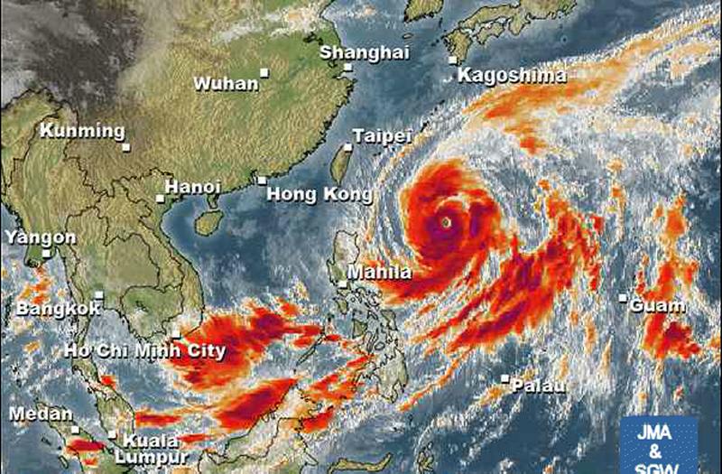
Typhoon VONGFONG / Ompong a bit weaker

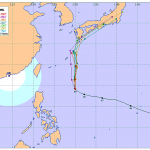
Typhoon VONGFONG / Ompong got a bit weaker this morning. Its central pressure increased from 900 hPa to 920 hPa. Latest satellite images show an eyewall replacement cycle(*). The typhoon is now moving north at 10 km/h. Weather satellite images show how this giant is dominating weather over the whole north-western Pacific.
Clearly visible eye
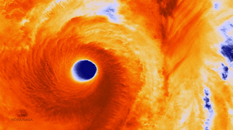
The eye
Eyewall replacement cycle
Eyewall replacement cycles, also called concentric eyewall cycles, naturally occur in intense tropical cyclones, generally with winds greater than 185 km/h (115 mph), or major typhoons (Category 3 or above). When tropical cyclones reach this intensity, and the eyewall contracts or is already sufficiently small, some of the outer rainbands may strengthen and organize into a ring of thunderstorms—an outer eyewall—that slowly moves inward and robs the inner eyewall of its needed moisture and angular momentum. Since the strongest winds are in a cyclone’s eyewall, the tropical cyclone usually weakens during this phase, as the inner wall is “choked” by the outer wall. Eventually the outer eyewall replaces the inner one completely, and the storm may re-intensify.
[GARD]
Related posts
 October 18, 2016 Typhoon HAIMA/Lawin upgraded to category 4 becoming a Super Typhoon Typhoon HAIMA/Lawin has been upgraded to cyclone category 4. JMA has already attributed their highest category: VIOLENT
Typhoon […]
October 18, 2016 Typhoon HAIMA/Lawin upgraded to category 4 becoming a Super Typhoon Typhoon HAIMA/Lawin has been upgraded to cyclone category 4. JMA has already attributed their highest category: VIOLENT
Typhoon […]- October 17, 2015 Great Danger in Aurora – Typhoon KOPPU/Lando now Cat.4 Great Danger in Aurora - Typhoon KOPPU/Lando has now developed an eye and has been upgraded to Category 4. PAGASA has hoisted Storm SIgnal […]
- March 31, 2015 Typhoon MAYSAK now Category 4 Typhoon MAYSAK is now Category 4 Cyclone. The storm is still heading straight west at 20 km/h. It got much stronger during the last 12 […]
- October 12, 2014 Typhoon VONGFONG / Ompong over Japan Typhoon VONGFONG / Ompong has reached Japan. Although it weakened to Category 2 and did not replace its eyewall, it is still a strong […]
- October 9, 2014 Typhoon VONGFONG / Ompong has turned North Typhoon VONGFONG / Ompong has turned North and is now heading towards Japan. At this moment the forward speed is very slow and cannot be […]


Recent Comments