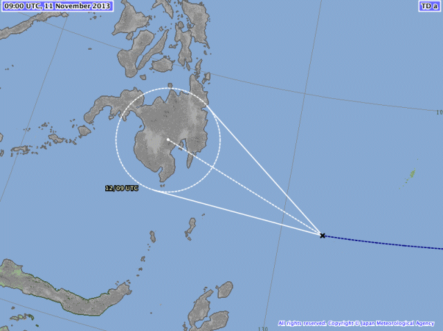
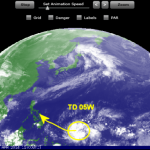
Tropical Depression “1331 / Zoraida” seems to stay more south. Latest JMA forecast tracks show that the TD will make landfall tomorrow morning in the south-eastern parts of Mindanao near Davao.

Other agencies maintain the northern track forecast with a line from Surigao going to southern Negros. We believe in JMA. In the past 6 years their forecasts had been the most reliable ones.
Wind will not be strong – about 45 to 65 km/h, but beware of the rain.
Rainfall may trigger floods and landslides!
We keep an eye on this coming storm:
Current weather is here 
Animated weather movies are here 
Related posts
 November 11, 2013 Tropical Depression “1331 / Zoraida” got a bit weaker The new Tropical Depression “1331 / Zoraida” got a bit weaker today. The pressure raised from 1000 to 1002 hPa. Forecast for tomorrow is […]
 January 14, 2015 The Pope’s Depression The Pope's Depression is approaching Samar. The Tropical Depression 01W will intensify and arrive in Samar when the Pope will visit Leyte. […]
 April 20, 2014 New Tropical Depression forming A new Tropical Depression (LPA 98W) is forming east of Palau. The TD is slowly moving westwards, towards the Philippines.
Weather is […]
 April 6, 2014 PEIPAH/Domeng – nobody knows PEIPAH/Domeng - no useful forecast available. The depression/storm is playing tricks with forecasters while it has entered PAR […]
 April 4, 2014 Tropical Depression changes direction The Tropical Depression (TD 05W ) still east of Palau moving west to northwest towards the Philippines.
The forward speed is about 15 […]





Recent Comments