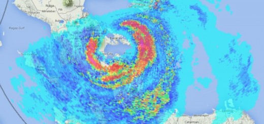
Typhoon RAMMASUN/Glenda over Manila Bay

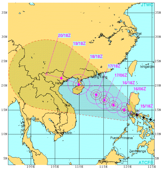
Typhoon RAMMASUN/Glenda had intensified to Cat. 3 last night when it made landfall near Legazpi City. The storm moved over Bicol, shaking Iriga City and Naga City. The storm continued over Laguna and Metro Manila. Currently it is leaving Manila Bay in direction of Bataan.
Relatives in Naga City reported heavy rainfall and some loose metal-sheets flying around. Some trees were cut or uprooted. At this very moment, 10:00 a.m., all Bicol is without power. The cellphone batteries are empty, so we do not get latest news.
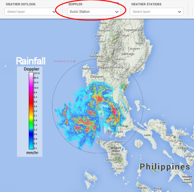
Strong winds still persist over Manila Bay while the typhoon is moving towards Bataan. Authorities in Bataan province evacuated residents in high-risk areas as the typhoon approached Balanga City. The typhoon lost its clear eye. The center is estimated near San Fernando. Heavy rains fall over Metro Manila.
A very good source of information is the DOST “Project Noah”. We recommend to go to the “Doppler” menu and activate Subic Station.
Rammasun/Glenda Storm data:
| Name (INTL. / local): | RAMMASUN / Glenda |
| Class: | Typhoon Cat. 3 |
| Time/Date of observation: | 05:50 AM on July 16, 2014 |
| Location of Center: | 14.2º North 121.6º East |
| Moving Direction and Speed: | West-Northwest @ 26 km/h |
| Moving towards: | Bataan |
| Distance from the Philippines: | Over Manila Bay |
| Estimated Date / Time of Landfall: | n/a |
| Max. Wind Speed near Center: | 165 km/h |
| Peak Wind Gusts: | 205 km/h |
| Minimum Central Pressure: | 956 hPa |
| Diameter: | 555 km (small) |
| 24h Rainfall near Center: | 200 – 400 mm |
| Max. Wave Height: | n/a |
| Here you find how to read and understand this data | |
Nearly real-time storm information
[GARD]



Recent Comments