First Typhoon 2014
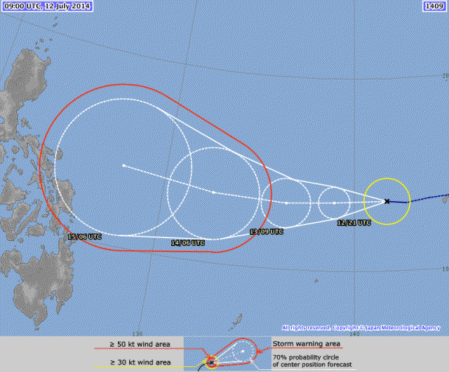
First Typhoon 2014. After Super-Typhoon NEOGURI passed by and hit Okinawa and south-western Japan, RAMMASUN will probably hit the northern Philippines.
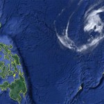
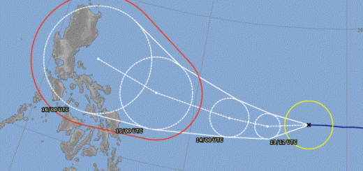
Tropical storm RAMMASUN is approaching the Philippines. Forecasters expect that it will become a typhoon of category 1 on Tuesday, July 15. Currently the storm is heading towards Luzon menacing the region between Manila and Subic Bay.
Silent Gardens strongly recommends people in central/northern Luzon to be prepared and to follow daily weather updates.
PAGASA as usual waits with their warnings because the storm is still outside PAR. .
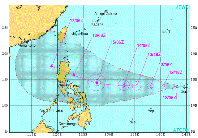
The storm seems to be a straight-runner, heading +/- west and turning northwards over the Philippines or even after having moved over our islands.
We recommend to prepare now! Tuesday it might be too late.
The US forecast is even more specific:
Rammasun Storm data:
| Name (INTL. / local): | RAMMASUN |
| Class: | Tropical Storm |
| Time/Date of observation: | 05:00 PM on July11, 2014 |
| Location of Center: | 13.6º North 142.1º East |
| Moving Direction and Speed: | West @ 20 km/h = 12.2 mph |
| Moving towards: | Luzon |
| Distance from the Philippines: | 765 km E of P.A.R. |
| Estimated Date / Time of Landfall: | n/a |
| Max. Wind Speed near Center: | 65 km/h |
| Peak Wind Gusts: | 85 km/h |
| Minimum Central Pressure: | 996 hPa |
| Diameter: | 260 km (very small) |
| 24h Rainfall near Center: | 50 – 200 mm |
| Max. Wave Height: | n/a |
| Here you find how to read and understand this data | |
Nearly real-time storm information
[GARD]



Recent Comments