Typhoon NOUL/Dodong short update
Typhoon NOUL/Dodong is developing now quiet fast. It is already a Cat.2 Typhoon at a central pressure of 956 hPa. Its forward speed has also increase to 24 km/h. All forecast tracks have been...
Typhoon NOUL/Dodong is developing now quiet fast. It is already a Cat.2 Typhoon at a central pressure of 956 hPa. Its forward speed has also increase to 24 km/h. All forecast tracks have been...
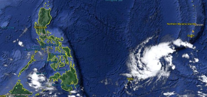
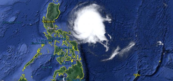
Typhoon NOUL/Dodong has gained strength and has entered PAR. The cyclone has turned northwest and has increased forward speed to 15 – 19 km/h. GDACS has issued a RED ALERT. Global Disaster Alert and Coordination...
As predicted, Cyclone NOUL will be upgraded to a Typhoon Category 1 today. This might even happen a bit earlier. Central pressure went down from 985 hPa to 976 hPa. Wind speed near the...
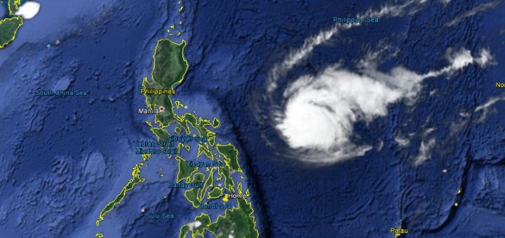
Tropical Storm NOUL is currently moving slowly westward. Japan Meteorological Agency predicts that Tropical Storm NOUL will become a typhoon category 1 tomorrow. Tropical Storm NOUL is gaining strength. The central pressure went down from...
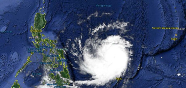
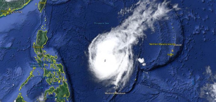
The Tropical Depression seen end of last week got stronger and better organized. Tropical Storm NOUL is currently moving slowly west-northwest. Japan Meteorological Agency predicts that Tropical Storm NOUL will become a typhoon category 1 within the...
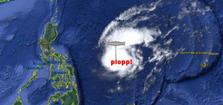
A Topical Depression is approaching the south of the Philippine islands. The depression is still out of PAR (the Philippine Area of Responsibility) and everybody is more interested in Pacquiao vs. Mayweather. But this Topical...
Dry – El Niño is almost here. Over in Bohol they already had water problems begin of April. Here in Camiguin, especially in Agoho, it didn’t rain now for 2 weeks. Spring water levels are lowering and...
The storm MAYSAK/Chedeng belongs to the past. The Doppler radars show some light to rainfalls in norther Luzon. In some parts the rainfall is although heavy. On the east coast of Luzon waves are still high...
Tropical Storm MAYSAK/Chedeng behaved strangely last night. It almost lost all of its energy and got completely disorganized. But this morning it showed up again. The animated satellite images clearly show this strange behavior....
Tropical Storm MAYSAK/Chedeng – Lucky Philippines again. The monster typhoon seen this week approaching our islands has lost most of its destructive energy. The Doppler radar stations on the east coast report light to medium rainfall. This...
Typhoon MAYSAK/Chedeng again got weaker last night but got a bit better organized. This makes us think that the storm will reach the coast of Aurora/Isabela tomorrow morning still as a typhoon category 1....
Typhoon MAYSAK/Chedeng showed a really strange behavior today. It changed its cloud shape from the usual typhoon doughnut to a pear and then an inverse comma. Being still a Typhoon Cat.2 it is continuing...
Typhoon MAYSAK/Chedeng is progressively weakening. At this moment it has still category 2 strength. The storm is getting disorganized in the dry air. There is hope that it will stall completely within 24 hours....
Typhoon MAYSAK/Chedeng is still approaching. PAGASA and other government agencies start now to inform people. Don’t mind this is the Philippines. For 5 days now we follow this cyclone (aka. typhoon or storm). But...
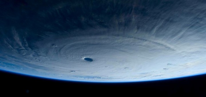
Typhoon MAYSAK/Chedeng continued to weaken while approaching the Philippines. Central pressure is now at 935 hPa. Forward speed slowed down to 15 km/h west-northwest. The title photo had been shot by Samantha Cristoforetti from...
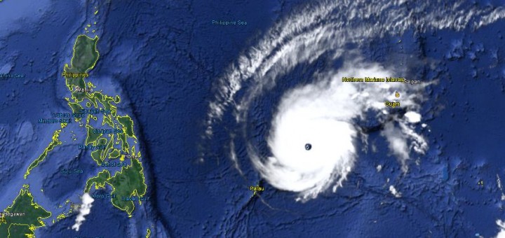
Typhoon MAYSAK/Chedeng weakens. The monster storm lost a bit of its strength today but is still extremely strong. The central pressure went up from 905 hPa to 925 hPa. The cyclone continues west-northwest at...
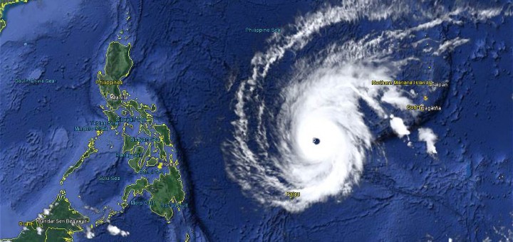
Super Typhoon MAYSAK again got stronger last night. The central pressure of the cyclone had been down to 905 hPa. This makes MAYSAK one of the strongest typhoons. Michael Padua, the famous meteorologist from Naga...
Super Typhoon MAYSAK is just now developing its peak strength. The Saffir-Simpson scale attributes Category 5, Super Typhoon. JMA in Japan assigns “Ferocious” or 猛烈な. Wind speed is now up to 280+ km/h. This typhoon...
Typhoon MAYSAK is now Category 4 Cyclone. The storm is still heading straight west at 20 km/h. It got much stronger during the last 12 hours and has now a central pressure down to...
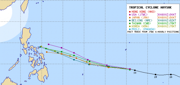
Typhoon MAYSAK is continuing on its westward track at 20 km/h. The current position is 8.8° North and 145.2° East. The cyclone has maintained its strength. Typhoon MAYSAK forecasts narrowing Compared with the forecasts of this...

Need to relax?
Stay at our Camiguin Beach Guesthouse. You are only one click away from vacation:


Recent Comments